Tongariro Landscapes 2
Photos from May and June 2008. Some of Taumarunui surrounds, but mostly of two trips to the mountain.
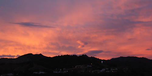
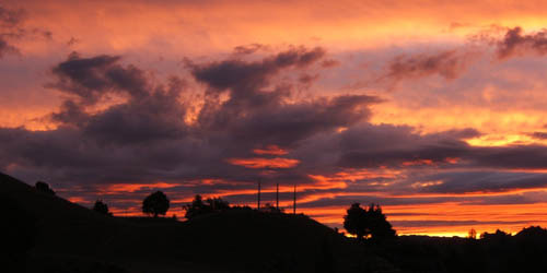
Taumarunui dusk
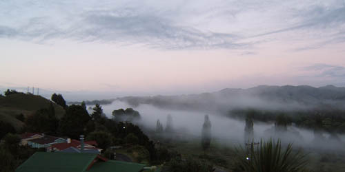
Morning mist in the Whanganui river valley.
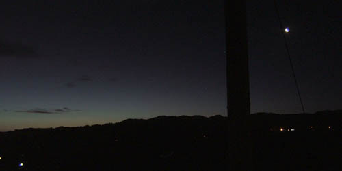
Taumarunui night lights at the other end of the day.
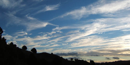
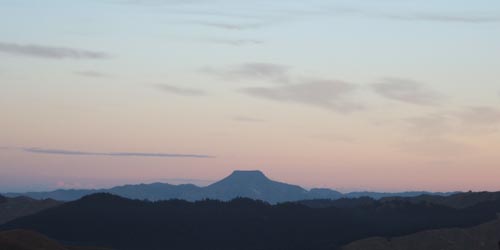
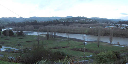
West view from our place on the hill.
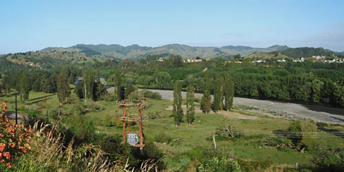
Same direction, different day.
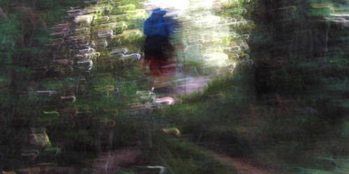
Forest walk.
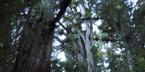
Some great podocarps in the Sunshine Reserve.
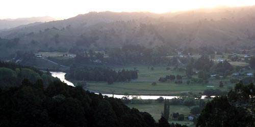
This river valley view from the top of the reserve.
From the saddle of the Taupo road, theres a lookout tower and this view of Hikurangi.
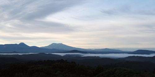
Looking south to the mountains.
May 29 Ruapehu day climb. Getting an earlier start this time.
Mist in the forgotton world. Same southerly air flow pattern as the previous week. Even clearer this time i think.
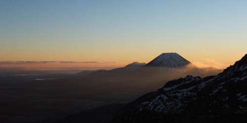
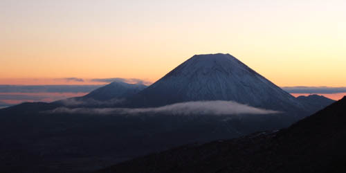
Sun starting to peek though the gap between Ngarahoe and Ruapehu.
The May dump has melted a bit.
Its really crisp morning a cold southerly wind blowing.
Almost at the notch now, climbing the `restful ridge`
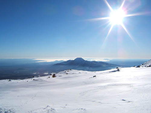
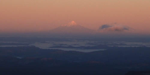
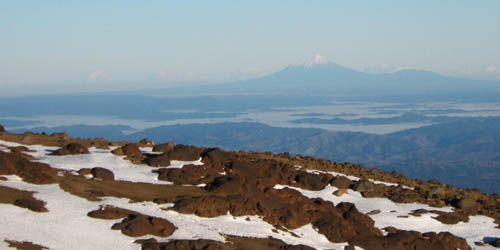
Lake Taupo on the horizon.
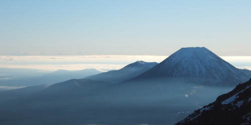
The notch center and the dome at right.
And down into the summit plateau for a wander.
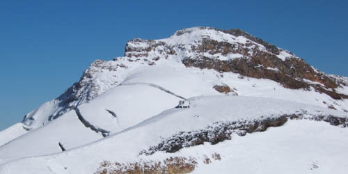
In the foreground is Dome shelter, where a climber lost a leg in last years minor eruption. Paretetaitonga in the background.
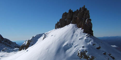
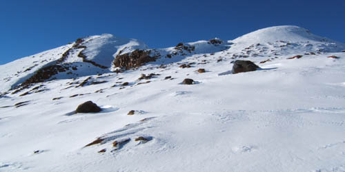
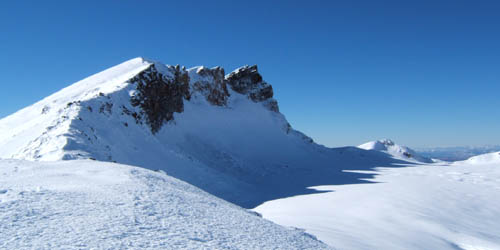
Cathredral rocks.
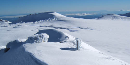
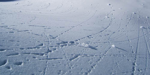
Looking back across the plateau to the notch at far left. Another seizmic marker in the foreground.
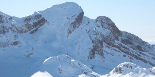
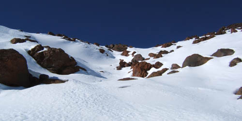
Tukino, southface, should be straightforward. Mangatoetoenui glacier drops away at right.
Looking back to last weeks walk.
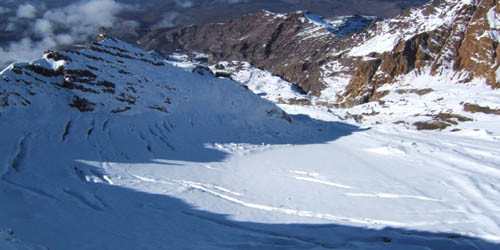
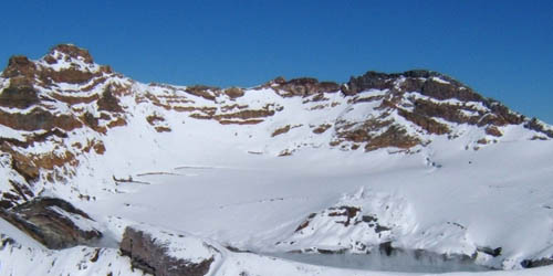
Looking down into the Whangaehu glacier.
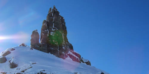
Kind of side/back view of the rocks.
Snow softening as I make my way across the plateau heading this time towards to gap above knoll ridge.
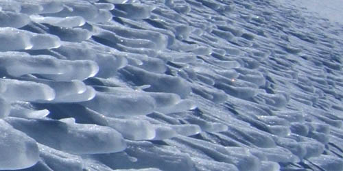
Just in the gap is this ice formation, caused by the westerlies howling through the gap.
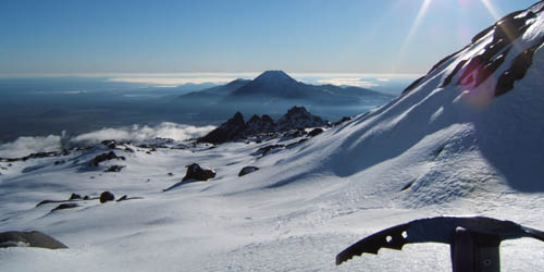
At the gap looking north to Tukino, and Teheuheu hidden behind.
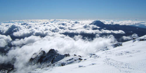
Some midday cloud arriving, and the high draws nearer.
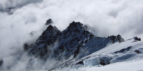
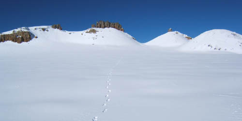
The Pinnacles looking mistical.
Looking back up the direct route diectly behind the top of the knoll ridge t-bar. Its a good route, just follow the slight gully.
Later in June there is a good sized low over the SI, which brings some good cold damp air, and over 1.5m of snow. We pick that weekend to go out it in it, June 29. All three highways closed, hail and thuderstorms in town, and buckets of snow on the mountain.
We arrive at the chateau after lunch on Saturday to driving snow and hundreds of kids making snowpeople on the golf course.
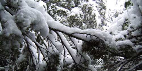
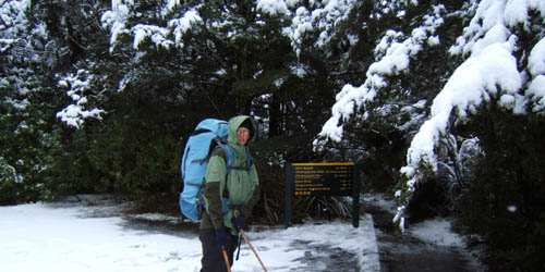
The laden trees hang low over the track as we duck and dive for 4 hours. Its normally a 2.5 hr walk.
Theres already a foot of snow on the ground, and more falling.
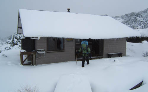
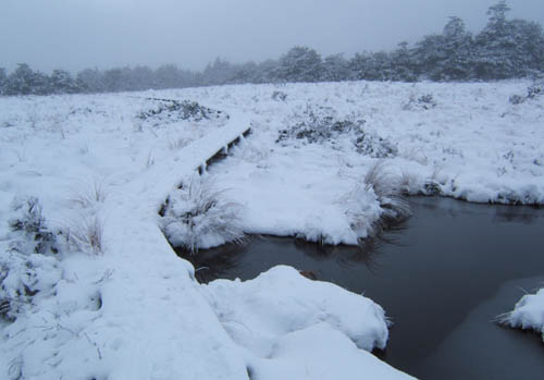
We are glad to finally arrive at the hut, as the landscape is bleak and dusk arriving fast.
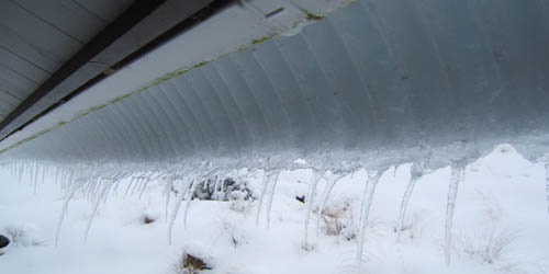
The snow loading on the roof is starting to creep off, somewhat in the manner of a glacier.
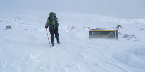
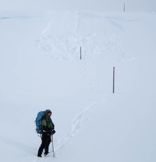
Thankful for the woodfire in the hut, the next day we headed off up valley into deepening knee deep snowdrifts. Crossing the open plateau back towards the Bruce Road, its a fascinating rather martian-like (albeit white) windswept landscape.
There is a pair of gullys which are filling up with wind drifted snow on the lee sides. This one gave way as it was stood on.
We lucked a ride down the road just before it closed again with one of the last 4wds off the mountain. But not before some good Bruce Road boot skating, which could well be the next winter snowsport.
Considering the weathermap, it was quite bizzare to get this brief clearing on our return to the chateau. See the snow sculpture far left. LOL.
We arrived home to find the river in flood, and news of atrocious weather. All we had was snow, all weekend.
An Autumn shot for comparison.
Photos index
- South Island 2005
- Taranaki Landscapes
- Taranaki Landscapes 2
- Taranaki Landscapes 3
- Ruahine Landscapes
- Taranaki Landscapes 4
- Taranaki Landscapes 5
- Taranaki Landscapes 6
- Tongariro Landscapes 1
- Tongariro Landscapes 2
- Tongariro Landscapes 3
- Canterbury Landscapes 1
- Motatapu Track
- Pyramid Route
- Kiri Track
- Winter Round The Mountain
- Tongariro Landscapes 4
- Ruapehu RTM
- South Island 2017
- South Island 2017 B
- South Island 2018
- South Island 2018 B
- Molesworth
- Sudden Valley
- South Island 2019
- Mt Fyffe Traverse
- North Island 2020
2008-11-18
www.zoneblue.nz/cms/page.php?view=tongariro-landscapes-2


