Molesworth
The trip through the Acheron Road to Molesworth Station could be put off no longer, because the road shuts for the winter on April 8th. The write-up is long, and it was not at all easy choosing from among 1100 photos. I'll just go ahead and say it at the outset, Molesworth is an incredible journey. Its also one that you'll need to change down a couple of gears for.
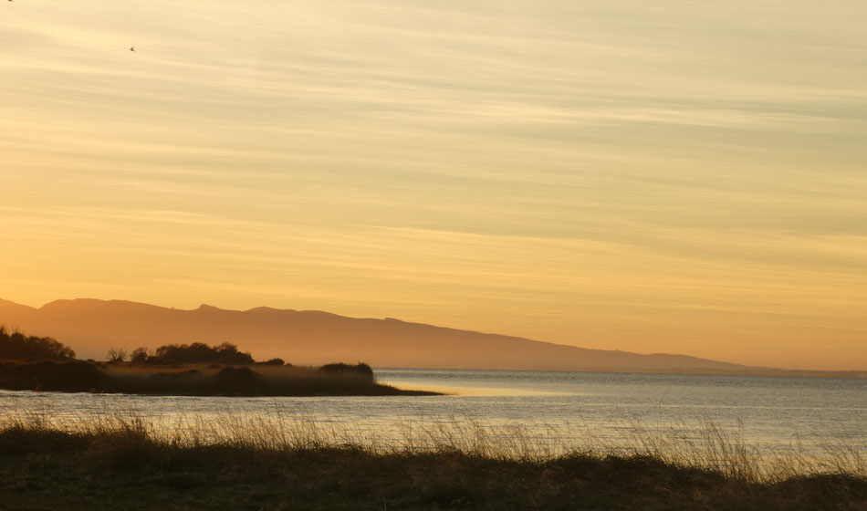
The last night at the lake never disappointed with the wild Nor-wester dying over night to a still dawn. Banks Peninsular in the background.
And its starting to quiet down towards the end of the tourist season.
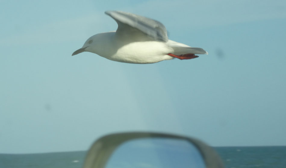
Making a stop at Amberly Beach, there are gulls riding the updrafts, virtually on top of the wing mirror.
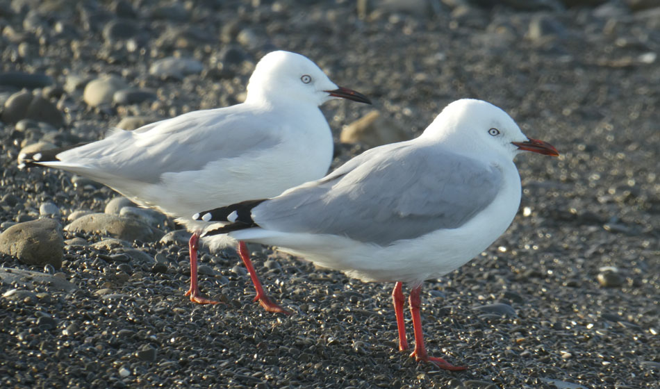
NZ has three main species of gull. Pictured here are Red Billed Gulls. The other common gull you see around the coast is the bigger Southern Black Backed Gull. The third is the now "most endgangered gull in the world" Black Billed Gull. The red bill is also steadily declining its population having fallen by 50% in the last 20 years. Mammalian predators are thought to be the cause.
Anyway, i digress. Time to point the bus north, into the wilds north of Hanmer.
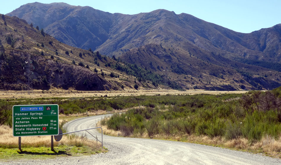
Most of the Marlborough / inland Kaikoura high country is owned by the state and managed by DoC and Landcorp Farming. Cattle are farmed, until such time as it all ends up another conservation park. Molesworth itself is 180,000 ha, and but there is also the St James, Rainbow, and Muller Stations.
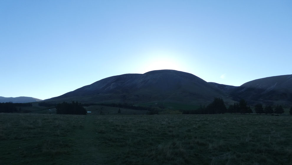
Once over Jacks Pass, you are straight away into this big sub-alpine environment where the subdued tones of tan and gold predominate. It takes your eyes some time to adjust and sensitize to this very limited palette. Four days is about right as it turns out. All these images are pretty much straight off the camera, preserving the original color.
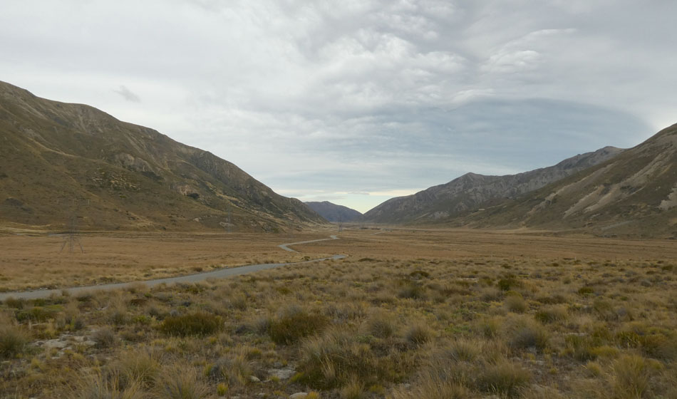
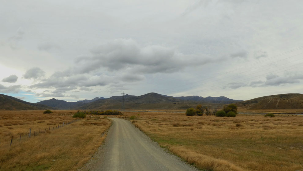
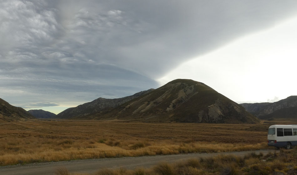
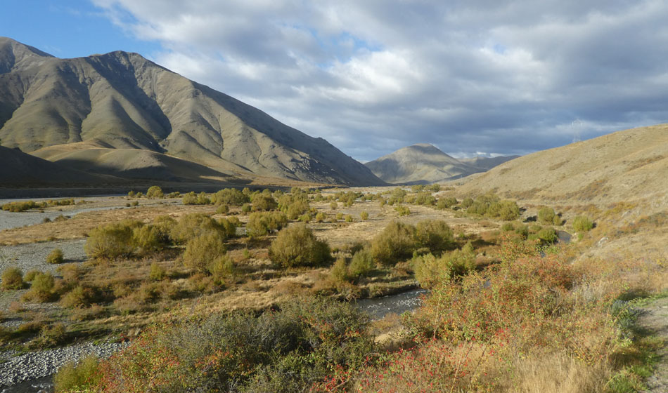
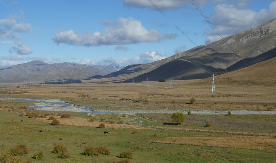
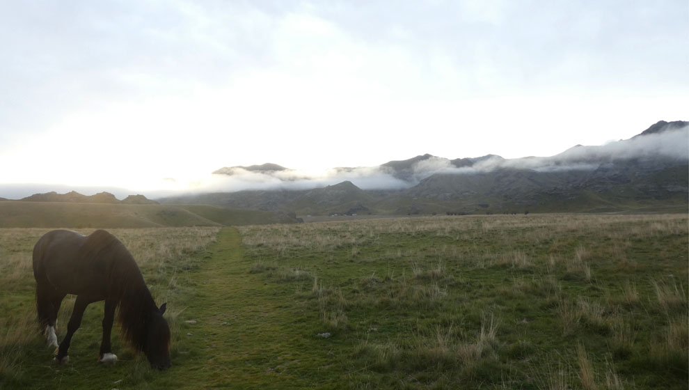
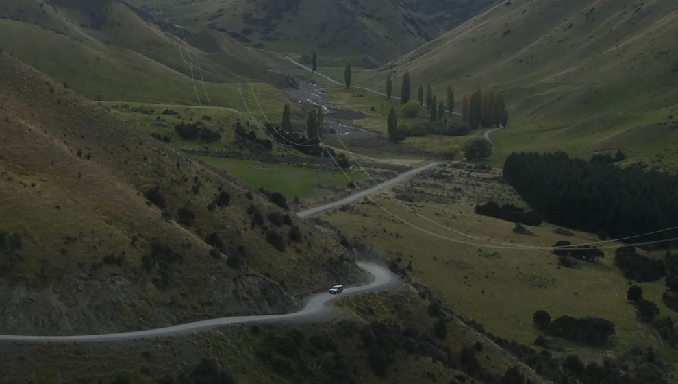
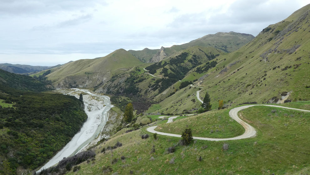
The landscape comprises long broad and relatively flat glacial carved valleys. A last minute decision is made to make the 40km detour to Lake Tennyson. 40km doesn't sound much but the entire station road network is one and a half lane, heavily corrugated, tourist discouraging goodness. 15km/hr is about all the bus is good for. In second gear. The entire way.
There's not a whole lot of obvious wildlife in the station. Mostly seen were paradise ducks, and the prolific feral cats. And this striking fellow.
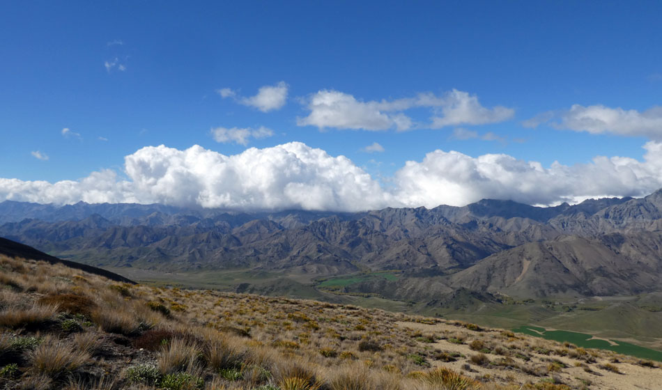
If one was a meteorologist one would find Molesworth interesting purely on account of its clouds. I guess the valley is wedged between the main divide and the two sets of Kaikoura Ranges, so lots or air disturbance.
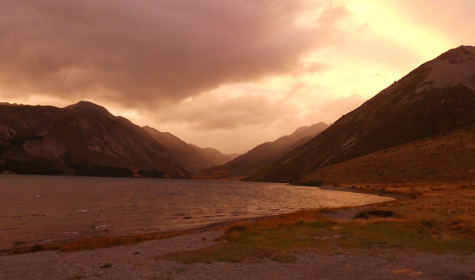
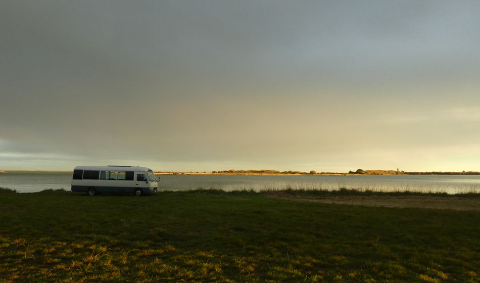
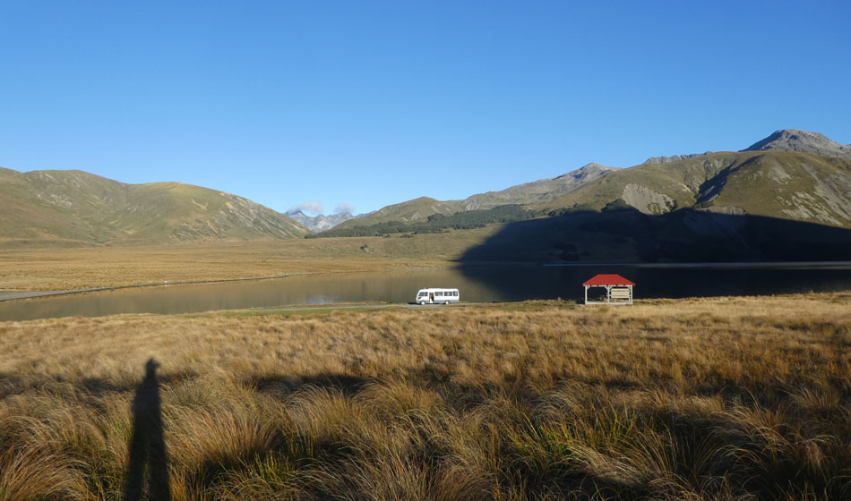
Arriving at Tennyson late in the day, a bit bushed from the concentration of driving on such roads. And its immediately clear to me, that the near total absence of traffic means that the bus is to be on its own for the two days at the Lake. Dusk colors, shepherds delight? Warms beyond warm.
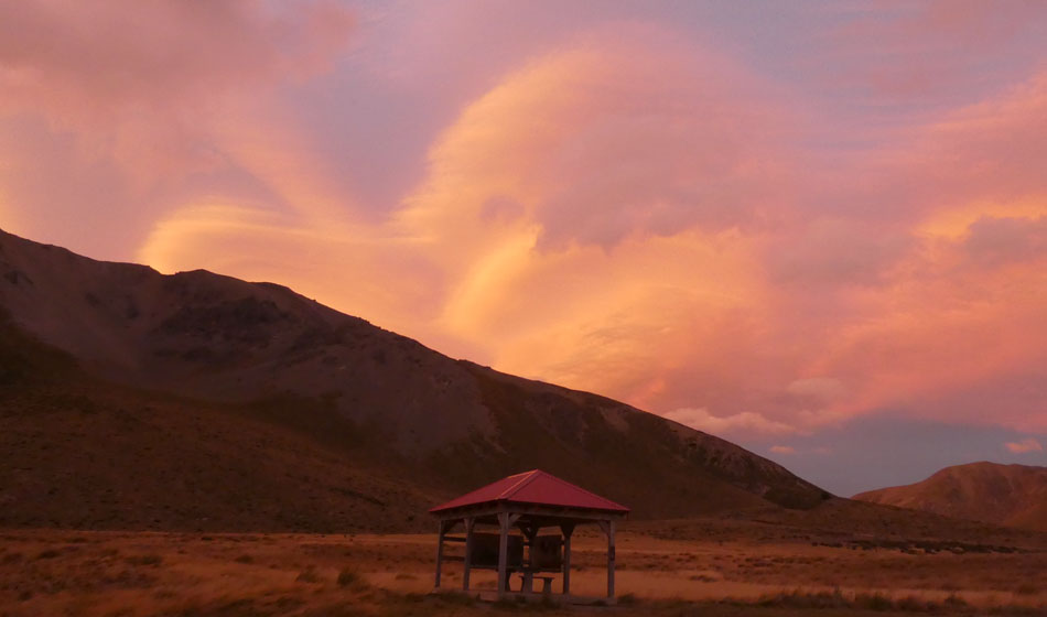
These zany clouds are just the beginning.
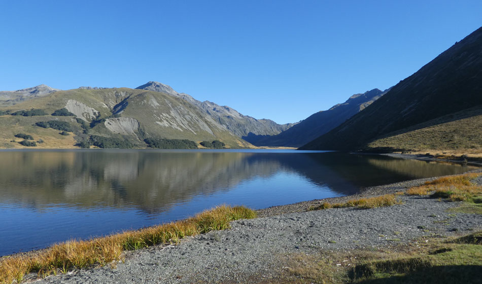
The new day is still and clear. Like only the south island can be.
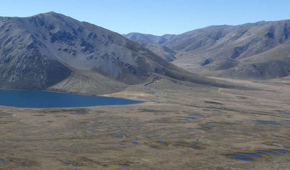
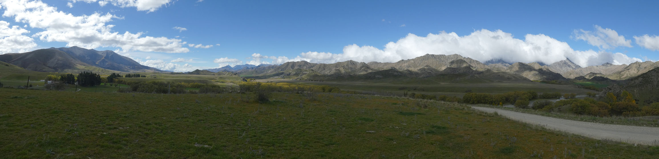
And from this you start to get a sense of just how vast the spaces are.
So, this pair of panoramic images are taken at two different heights while climbing a random (is anything ever random) hill to the south of the lake.
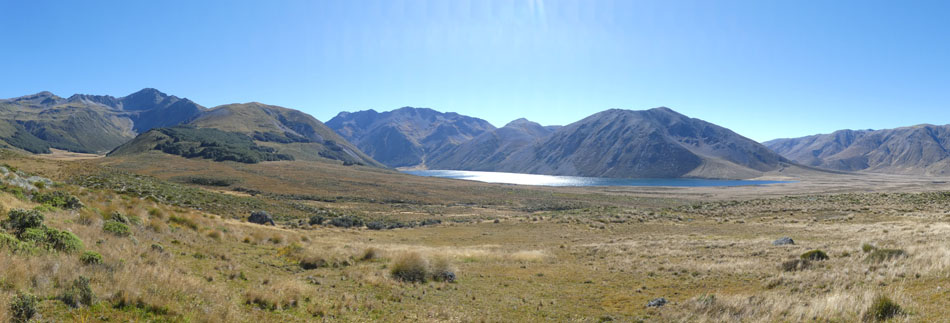
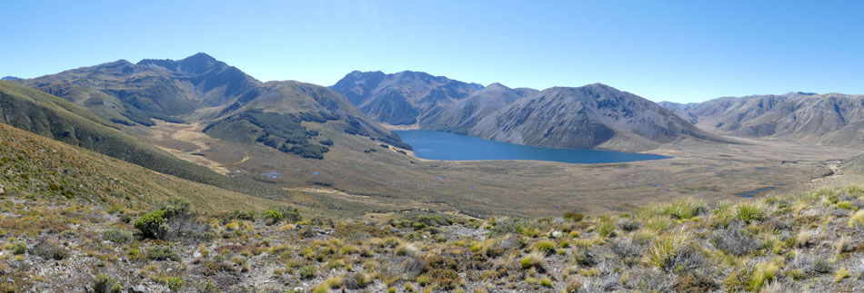
The hill to the left of the lake is Mt Princess, and it has in its fold, a little lake called the Princesses bath. A project for another day?
The coaster is the white spec just below center.
Its so incredible there's nothing for it, really, but to stay another night.
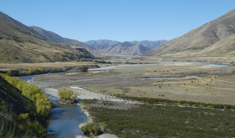
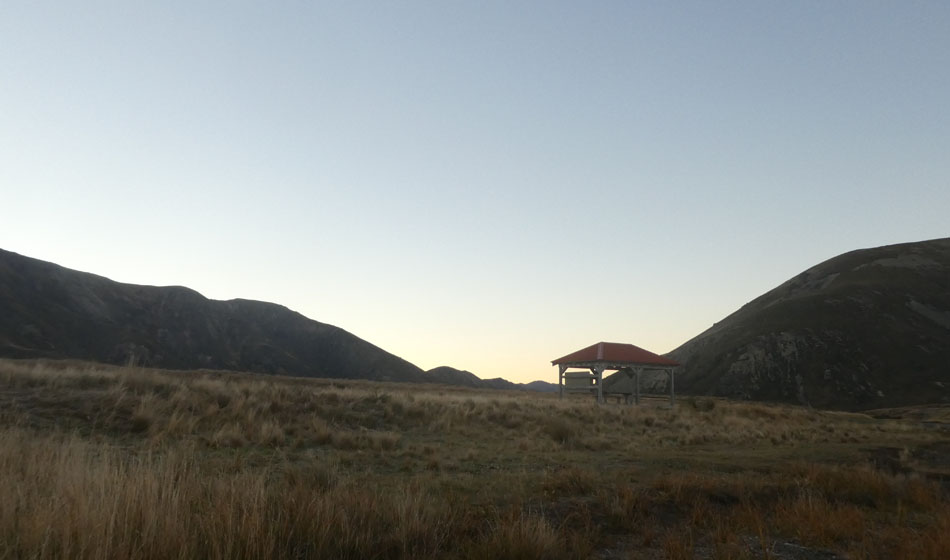
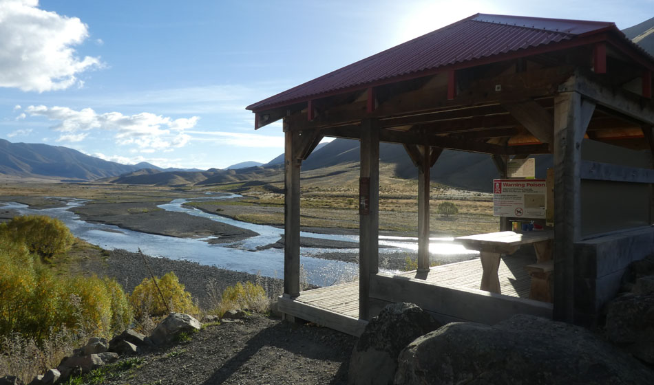
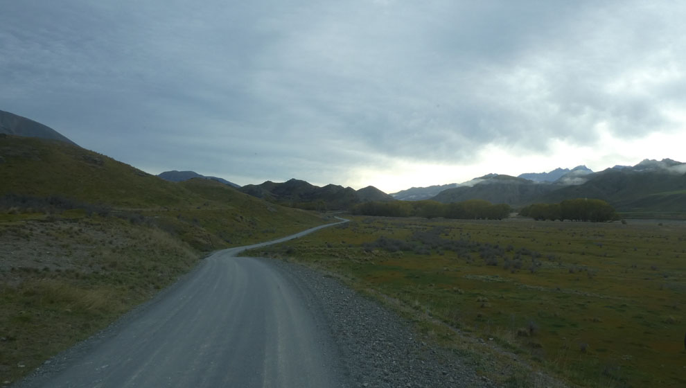
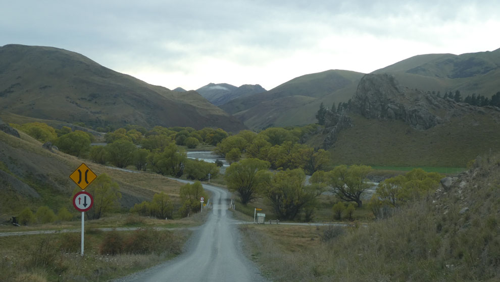
After retracing steps back to the turn off, we are now on the main Acheron Road, which is named after the Acheron River that runs NE for about 40km as far as the pass over into the Awatere. This valley has a little more closed in feel to it. At dead center is one of a series of information shelters along the way, decked out in station 'rock red'.
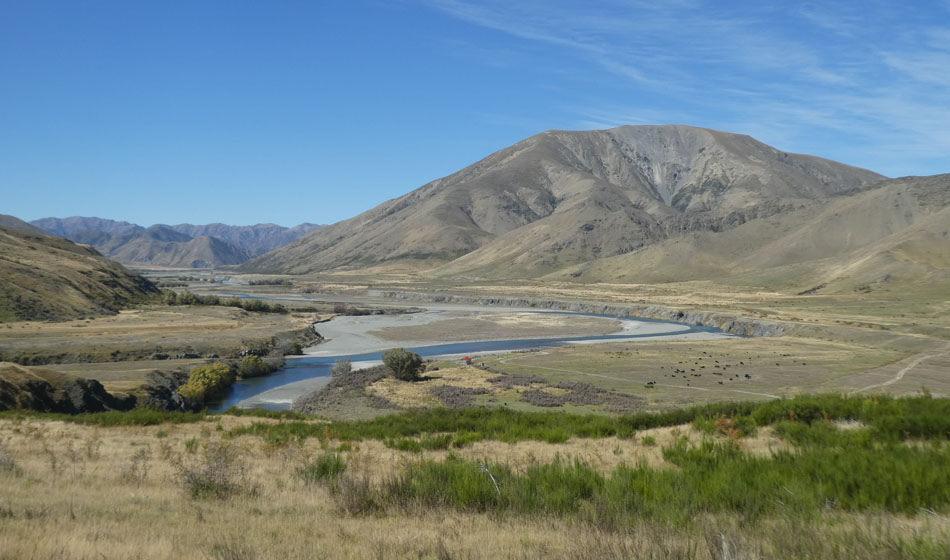
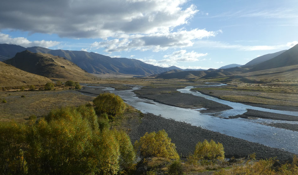
The road stays near to the river, with its blue green cloudy glacial silt, adding another color to the dulcet browns.
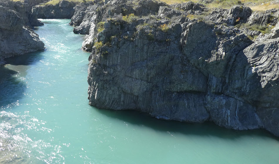
The rocks in the river hint at a violent geological past. As well as being an ex glacier there is also a major fault line which runs up the valley, the Awatere Fault. Which is one of a few that branch off of the main alpine fault. And which together were responsible for the 2016 Kaikoura earthquake. Which, fact of the day, was the second biggest earthquake in post colonial times.
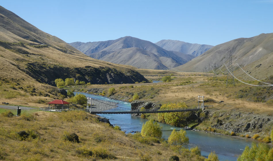
There are several swing bridges in the valley, built for mustering, and the power company, circa 1950.
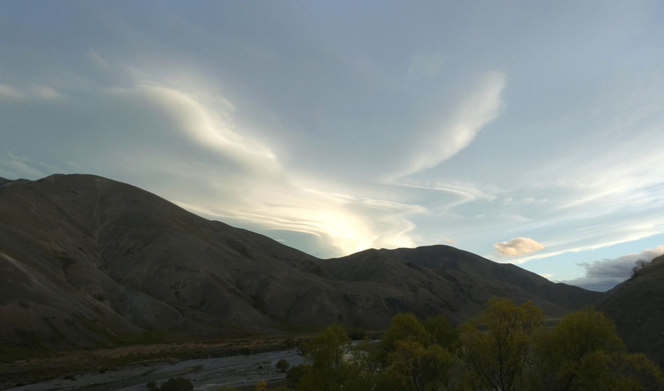
More interesting and unusual clouds.
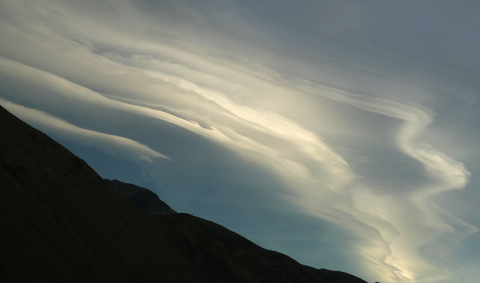
Ditto.
The further up the Acheron you go you start to see a few trees, willows mostly. In the foreground, Sweet Briar, introduced in the 1840s by some well meaning gardener, now a major weed species. I bet that person lost some sleep over that. Rabbits in 1858... nice game animal... stoats in 1883 to control the rabbits... oh the power of hindsight. On the flip side, briar is the source of rosehips and is actually a promising new industry.
The last shelter before the Homestead. It is built in such an idyllic spot, that a person cant help but dwell. Although it should also be remembered that there is 57kms of corrugations, before the gate at the homestead that is locked each night at 7pm ;)
The view.
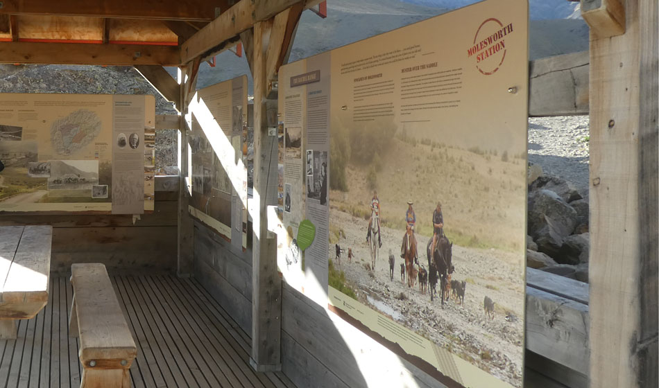
And inside are stories of station life. But oddly brought to life by the three actual characters pictured on horse back, actually turning up in their 4WD to have a beer or two.
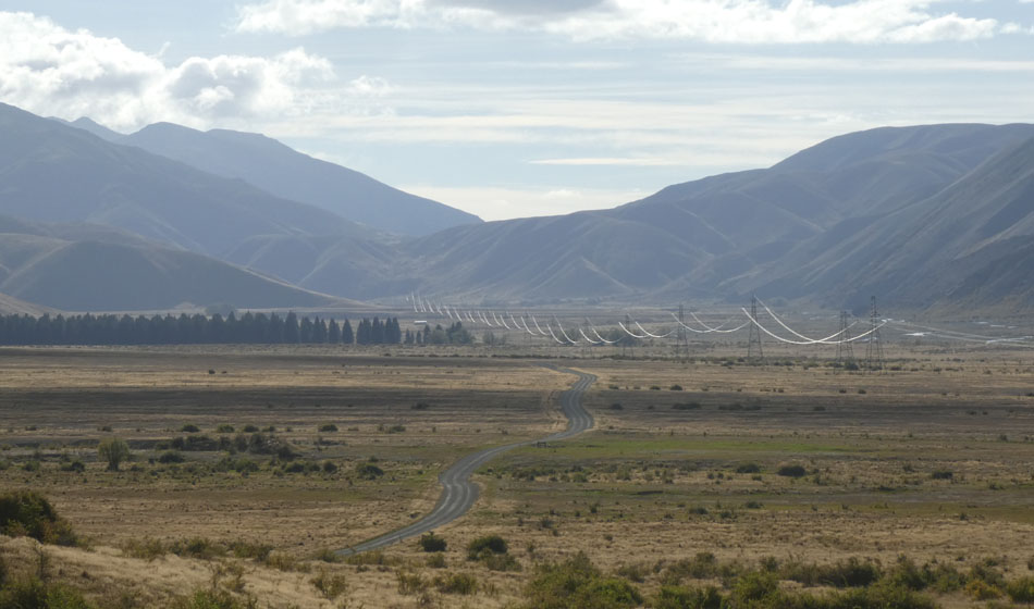
A companion on this journey through the station is the ever present high voltage power pylons. This is the 600kV DC link that joins the two islands, running all the way from Benmore to the Marborough Sounds, then under the straight to Wellington. In the spirit of all things chicken and egg, it is actually this power line that we today have to thank for the Acheron Road.
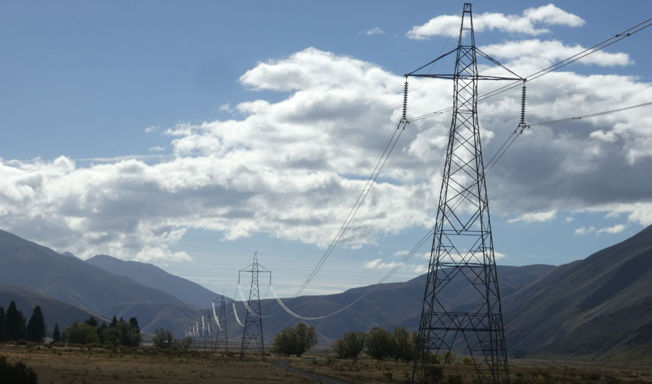
Just about every picture on this page includes at least one pylon. 5m deep footings, often dug by hand.
But in the scheme of things, compared to the landscape, they are tiny.
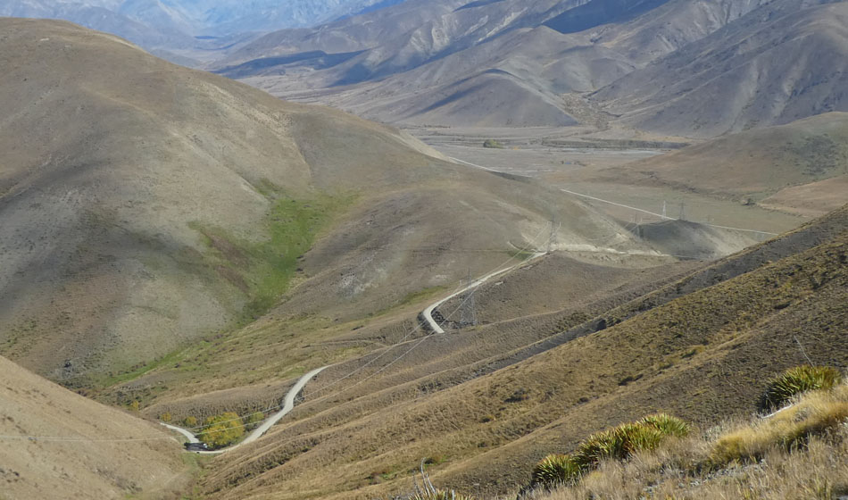
At the head of the Acheron is Wards Pass, which is a rare hill on the route, and its summit is 1100 odd meters. This picture is looking down on the pass from Mt Chisholm.
Looking into the Awatere, you are immediately greeted by the Inland Kaikouras.
But just before you get to the Homestead is a great spot to stop and look out over the station complex, and generally soak up the ambience of an incredibly beautiful valley. You can certainly see what brought the run holders here. Scroll left to pan through 180 degrees.
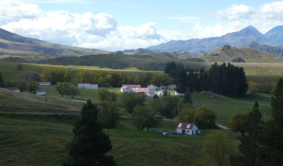
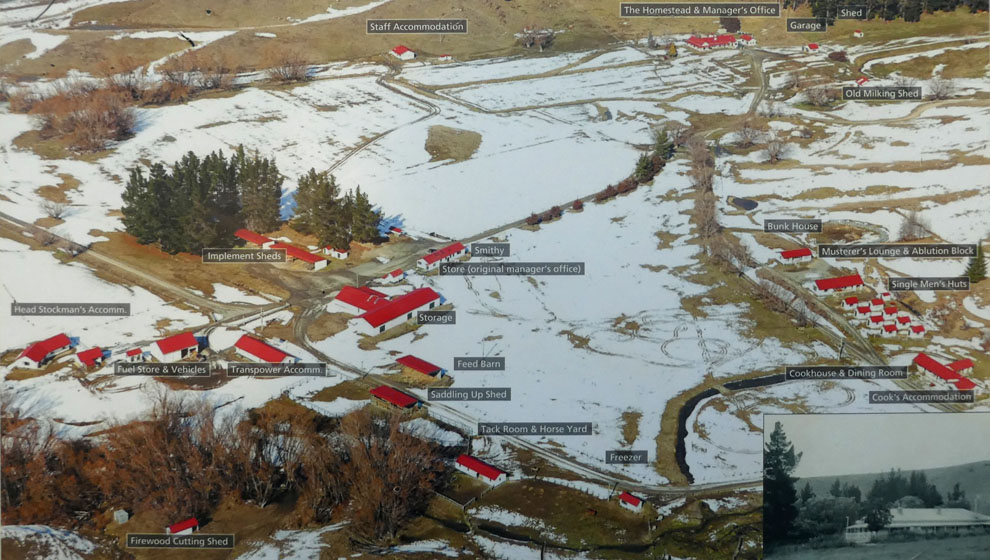
Molesworth Station buildings and homestead.
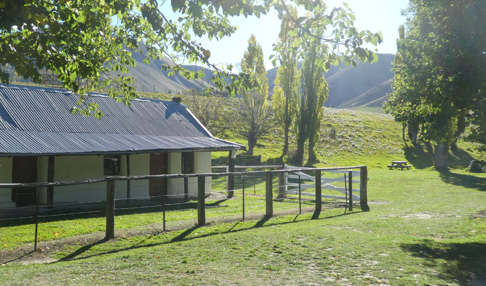
This is the original temporary Homestead, that was used until the present building was built. It is built of Cob, and like the one at Acheron is presently in a state of disrepair, having been red stickered by the earthquake.
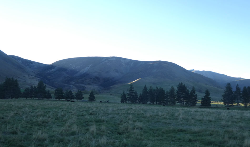
The day seems to end prematurely...
...and this hill, Mt Chisholm is the culprit, the sun disappearing behind it at exactly 5pm. The hill was renamed Chrisholm in recognition of the long time station managers services, i guess he was the guy that brought the station back from the dead after its original sheep operation went under from harsh winters, rabbits, over grazing, and erosion from the burn offs. However, i would have thought there was a bit of an irony in bestowing his name upon a hill that the entire station staff curse every day at 5. Maybe the guy was a hard task master.

This the official Molesworth Homestead campsite. Its just the bus... until late in the day another camper or two turns up. I guess this one was afraid of the wolves.

The sun reappears at 7am, which is something at least.
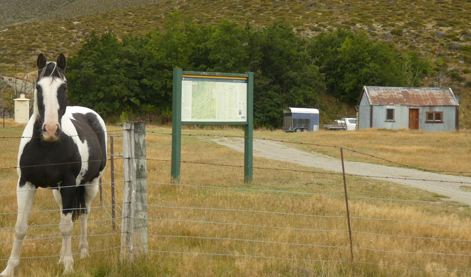
At which time i wander around attempting to capture the morning light on film. The station breeds all its own horses, which are still the mainstay for the annual musters. Ditto the 45 station dogs.
Molesworth station is the highest permanently occupied Station in the country.

On the road fairly early, to traverse the long leg up the Awatere Valley to Seddon.
Ditto.
Still more trees. And more clouds.
Starting to lose some altitude as we drop back down to the muggy lowlands. The air in the station was indeed very dry, but alas, people, noise, shinyness... Can i stay?
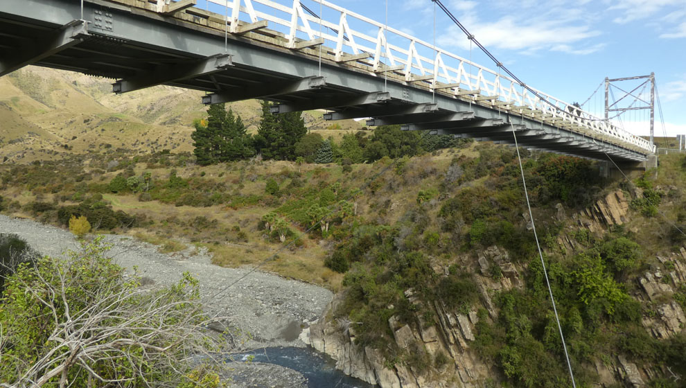
This is the Hodder bridge, one of the largest swing bridges around.
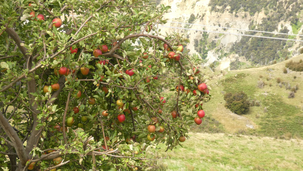
One of many wild apples found on route. Being harvest season, i also find spinach, watercress, sea lettuce and other wild goodies this trip.
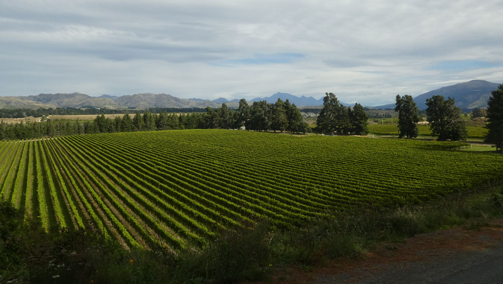
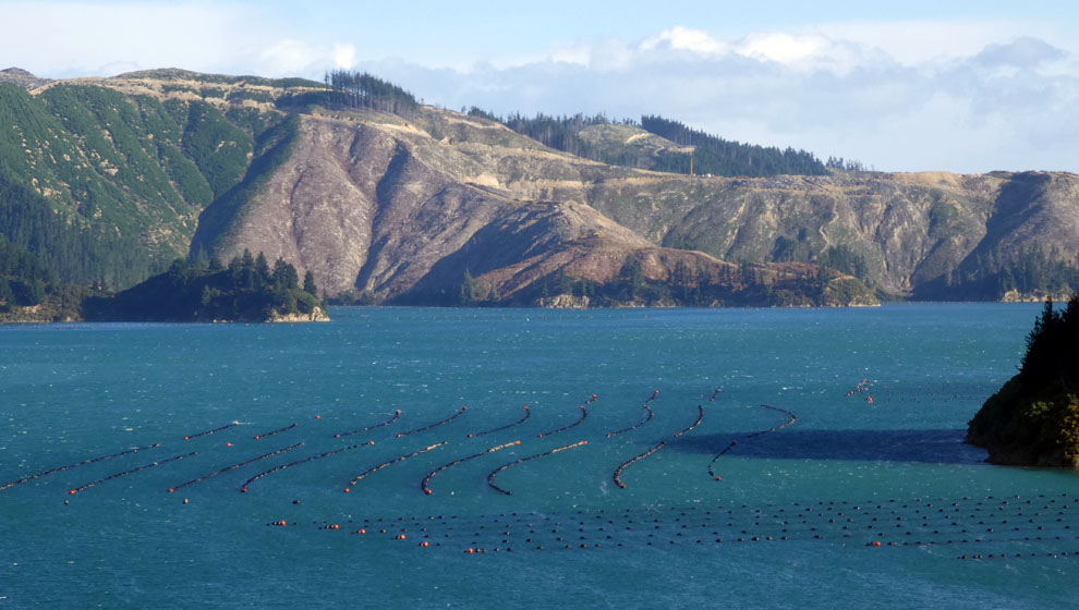
And finally emerging into the lower Awatere, home of "distinctive" Marlborough wines.
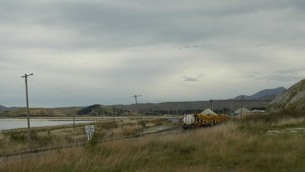
A quick visit to the Lake Grassmere salt works, source of much of NZ's salt.
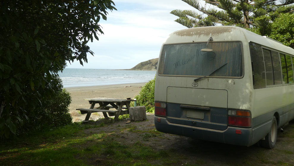
Before a restful transition night at Marfells Beach. 275km of gravel road all told, the bus is dirty with a capital D.
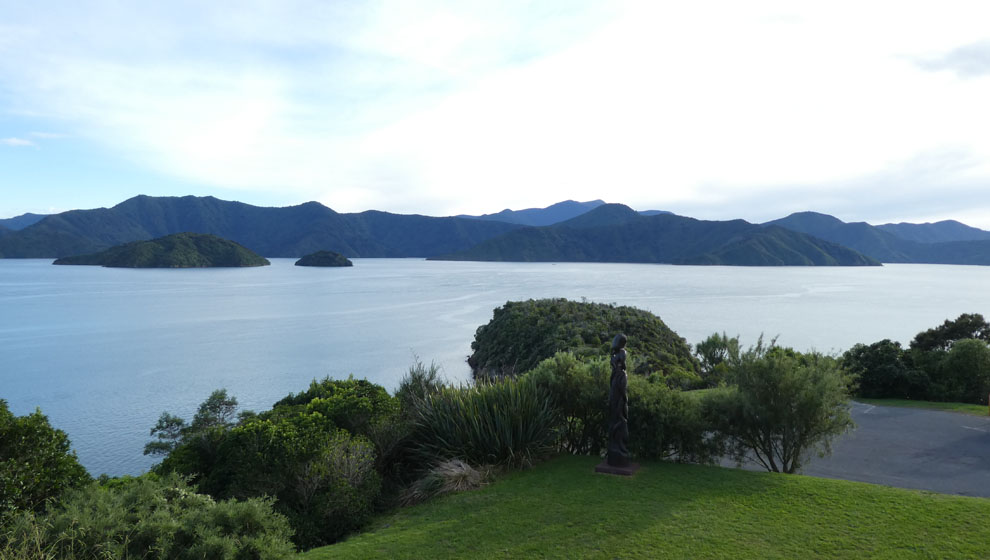
Then a couple of nights in Picton.
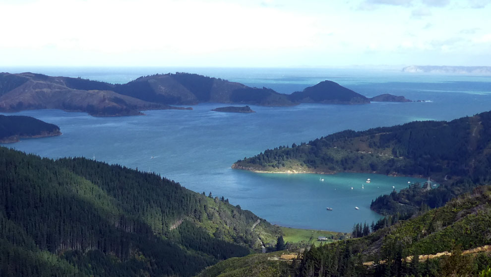
And camping by the quiet lap lap of the sounds.
With perseverance a suitable place right on the water was eventually discovered way out in the east arm of Port Underwood. Magic. Just watch out for the logging trucks, they stop for no one. And take up 60% of the road. Not a good combination.
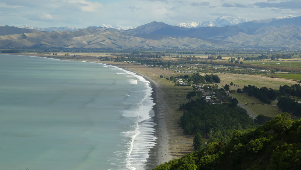
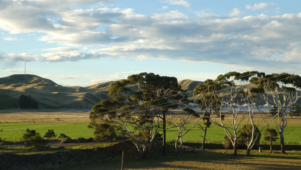
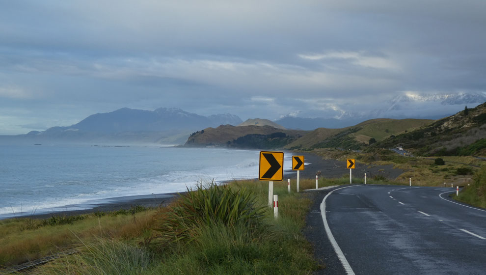
While it was tempting to spend more time in Marlborough, I've places to be, and the remaining week will be just enough to experience the Kaikoura coast. This is coming down to Blenheim from the windy coast road. Note as i did the fresh snow on the hills.

And this shot of vast new grape growing acreages.
A quick visit to the Wairau bar, where again clouds featured.
Past the salt works (again).
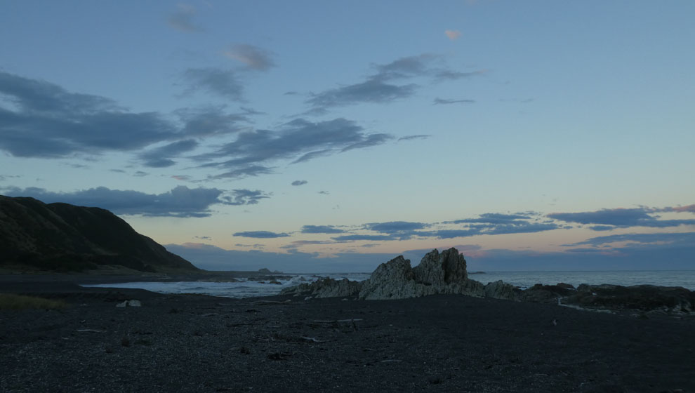
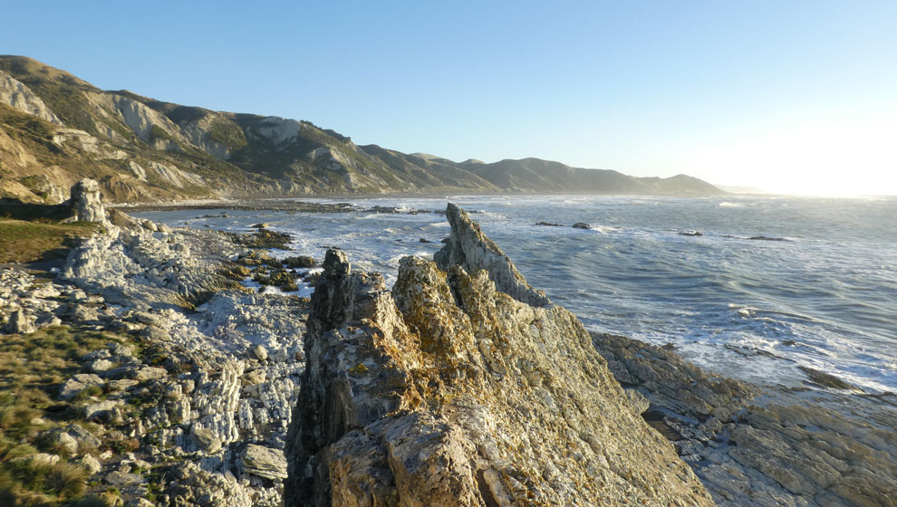
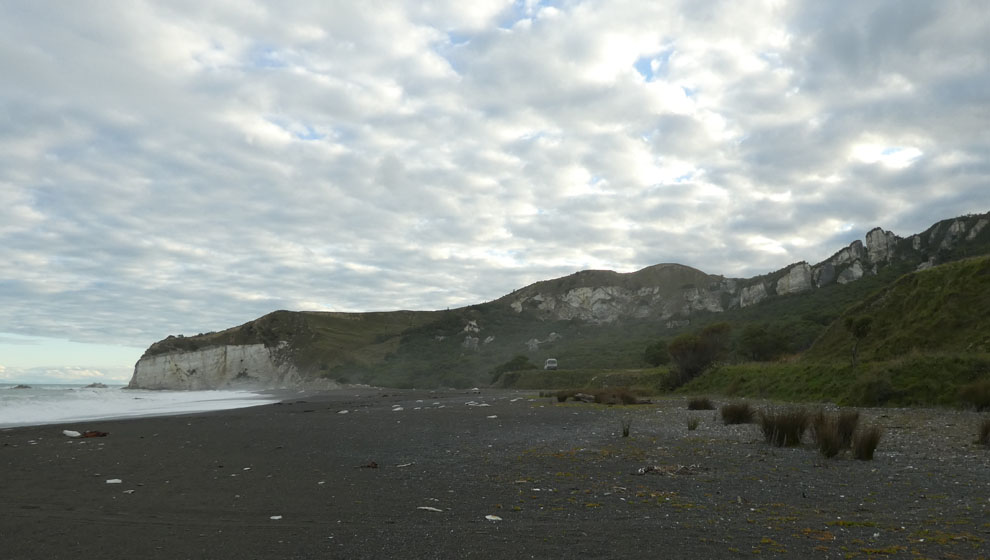
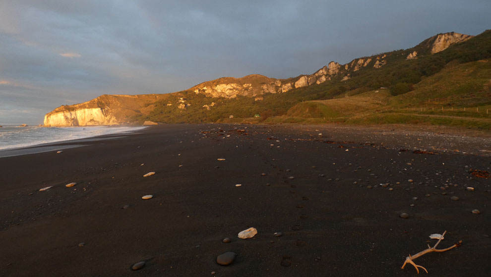
To discover the gem of the north coast, Wards Beach. The sea here is east coast wild, and limestone is everywhere.
At dawn i go and check out the Chancet Rocks.
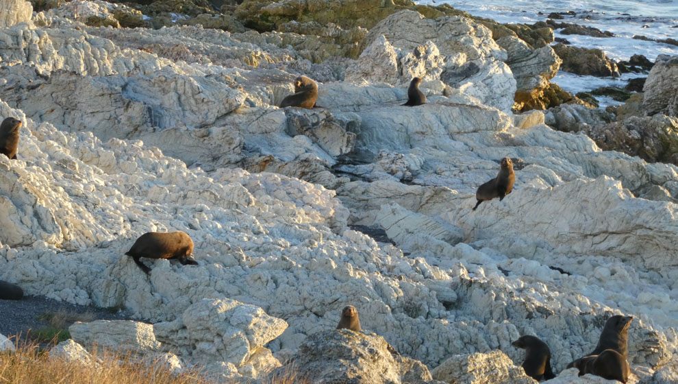
Where there is a seal colony.
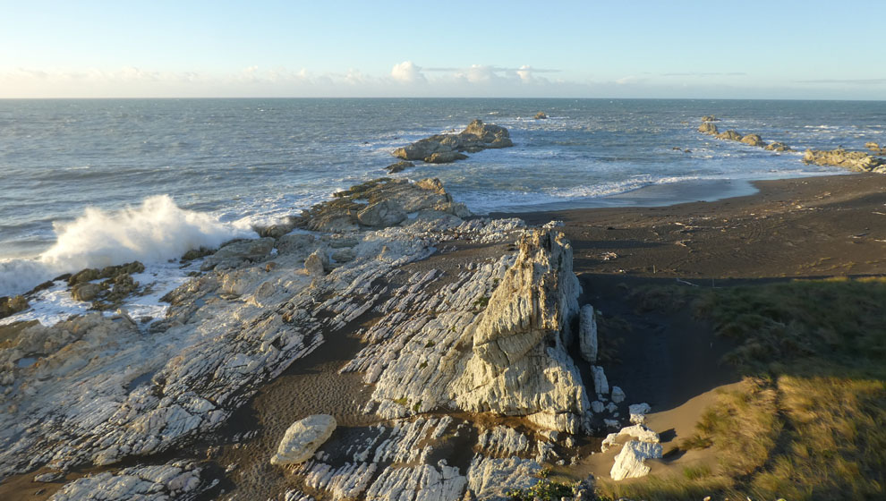
As well as these dramatic eroded limestone features. One of which i climb to get a better view of the colony.
Thus. However the fly in the ointment is that i am upwind. And i can tell that they can tell by the way they cock their heads.
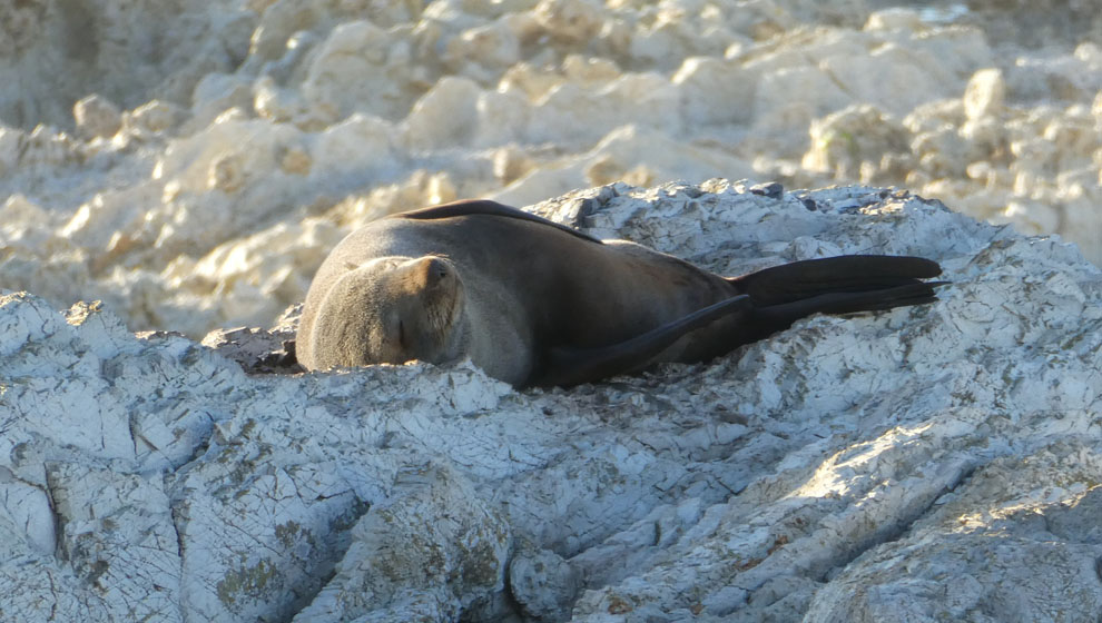
So i relocate into the dunes, and spend a couple of hours laying quietly observing the comings and goings of seal behavior. I take a particular interest in this character.
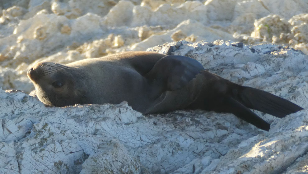
It spends a lot of time scratching its back. Unfortunately the photos don't convey the way these fascinating creatures move. Which is best described as being like shrink wrapped humans.
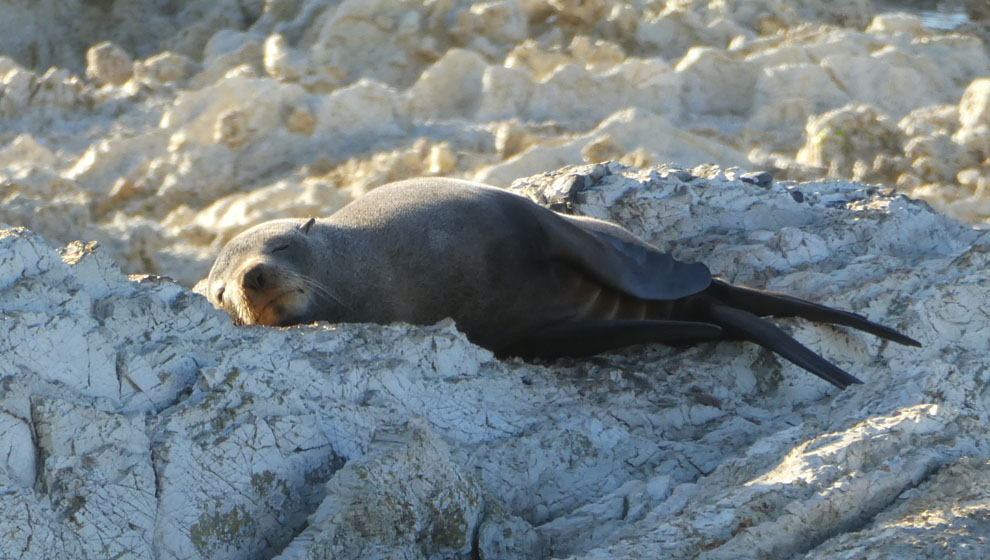
Oh so cute.
Next day i take a side trip to try to get to Sawcut gorge, but its closed "very dangerous" after the earthquake. A road not for the feint of heart, BTW.
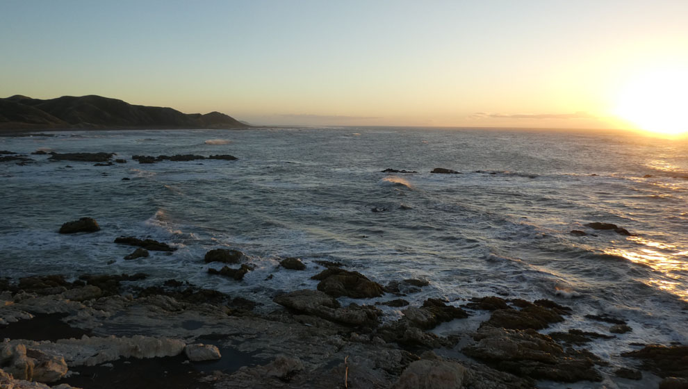
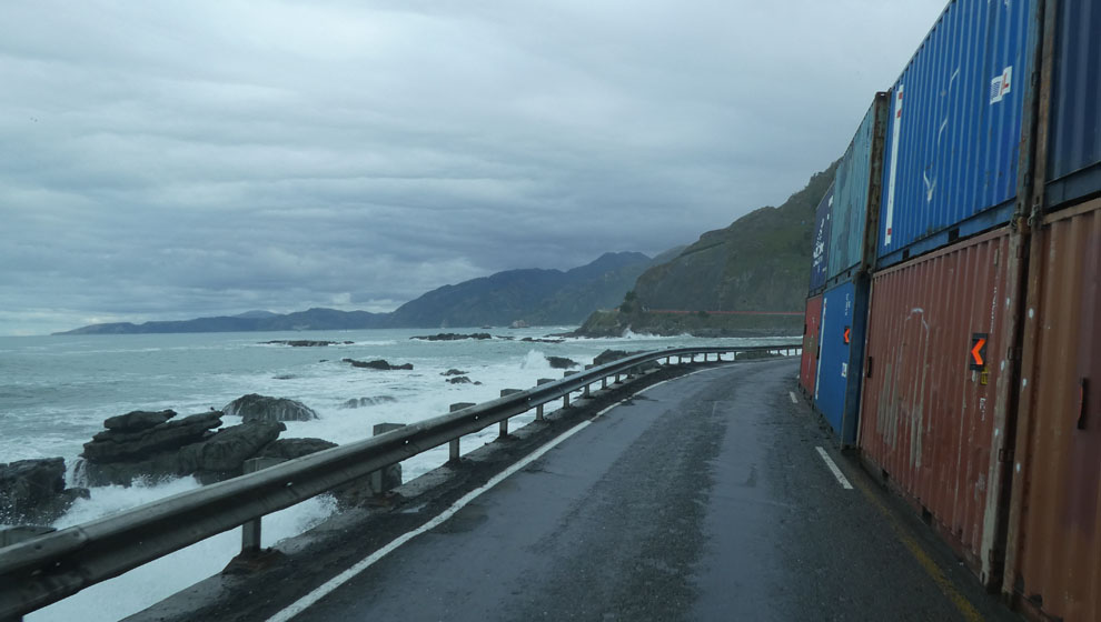
Then, stopping a night by the Ure River, and on southwards towards Kaikoura. The sea is just wild, and crashing all the way down the coast.
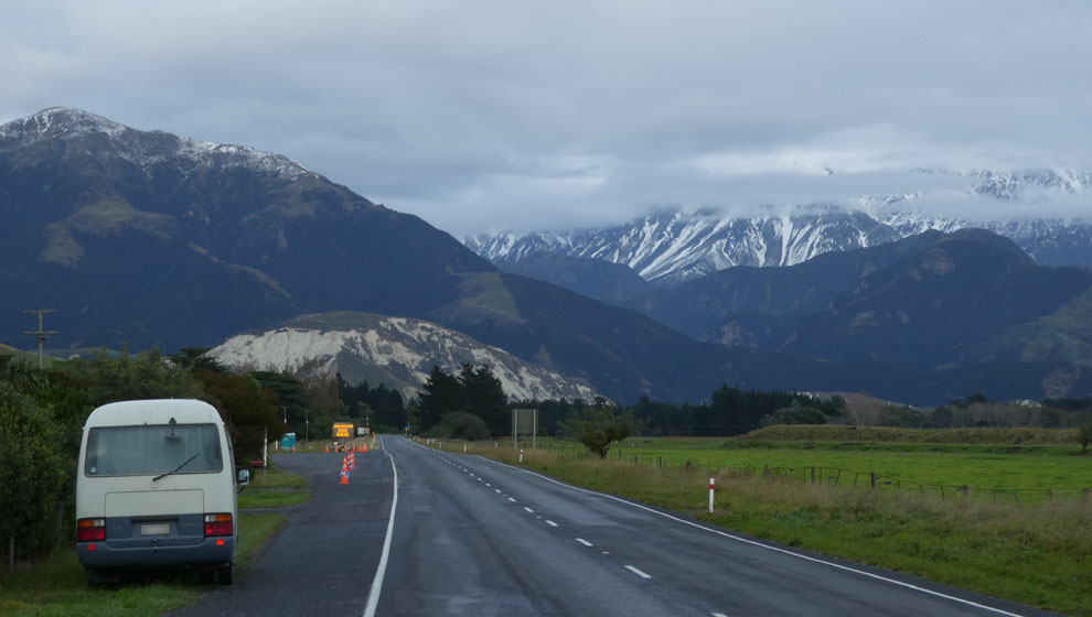
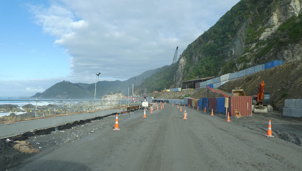
Then at Clarence, the start of the earthquake rebuild zone. The 2016 earthquake was second only in size to the 1855 Wairarapa quake. There were two fatalities, a 7m tsunami, and 400 aftershocks M4 or bigger. The current cost estimate to repair this road is 1.4 billion, with a B. For travelers, Clarence brings more gates which are locked and unlocked at 7 each day. And signs saying no stopping (rockfall).
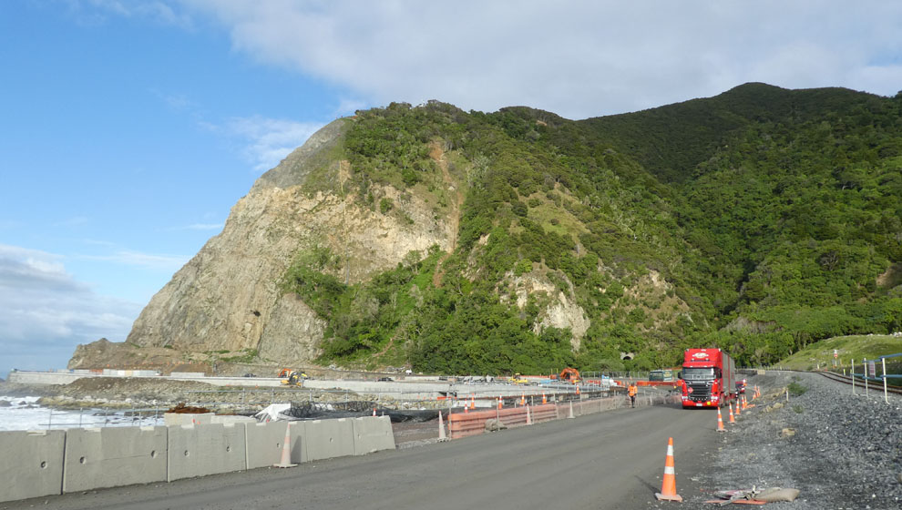
After a series of smaller road works, you arrive at Ohau Point. Here are a pair of of big slips that we saw in the news. Sea level lifted 7m by the quake. 8000 truck loads of material removed.
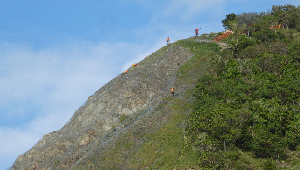
If you have good eyes you'll see the abseilers at work, dislodging loose material and securing netting. This is the very top of the previous photo, 180m above the sea. That is what i call a day at the office.
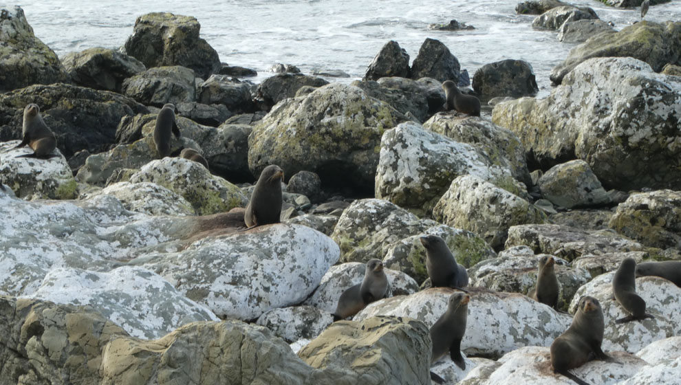
The seals are slowly returning to their homes here, and the construction workers are using a variety of fences to try to keep them out of harms way. They seem unusually alert in this picture, but that's probably not surprising, given the activity level.
And a couple of photos of the range of techniques they've used to stabilize the cliffs. Five tonne concrete lego blocks, rock mesh baskets, nets, shipping containers Christchurch style, all sorts.
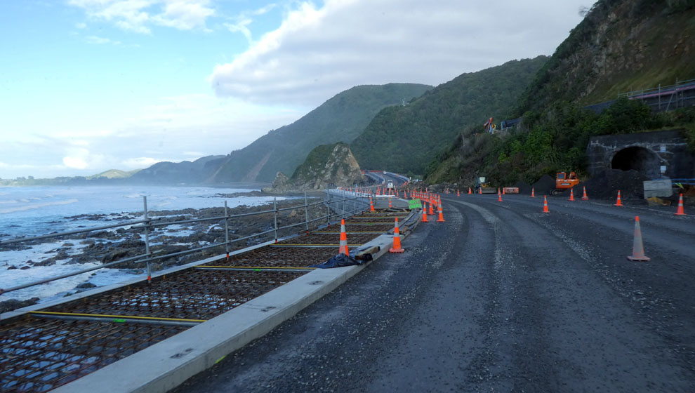
But after all the temporary work needed to get the road open, they still basically need to build one long new sea wall, and that work is now underway as you can see here. Their plan is to use the new land that was uplifted to build a new road further out from the slip, and use the old road as a kind of moat to catch rocks.

And after several long stop and gos, where the road crews have clearly been instructed to wave, you come out the other side at Maungamanu.
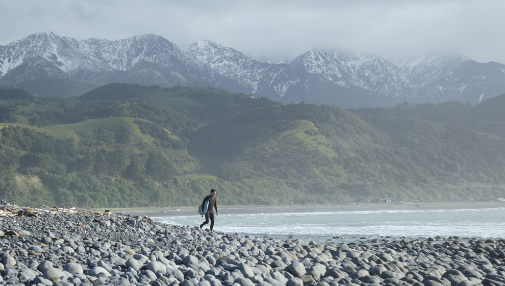
Having been vehicle bound, myself and just about everyone else gets out for a stretch. The rocky coast lets up to some beaches south of Hapuku.

The surf is still pounding it. Waves that are two or three story's high, like nothing you have ever seen.
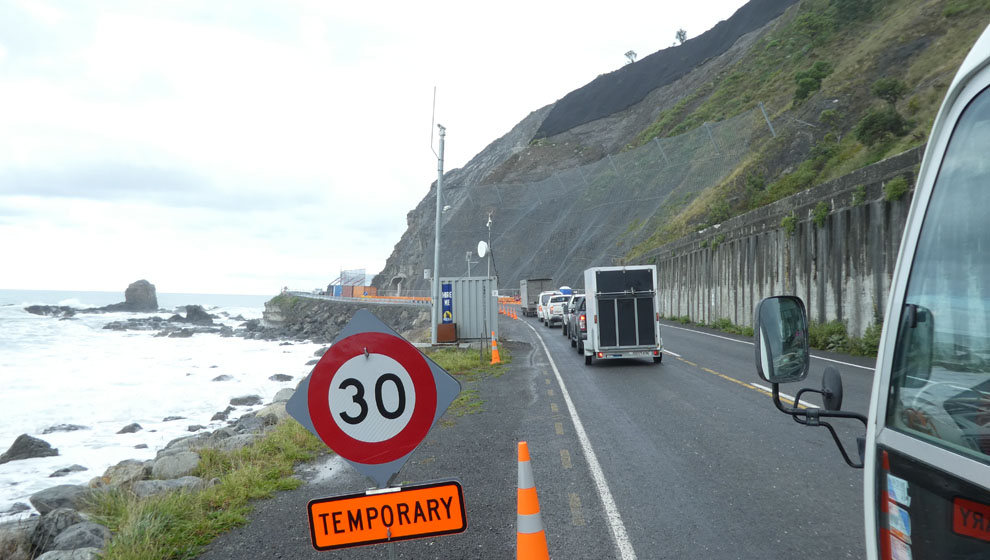
Despite the cooling weather Kaikoura is still quite the tourist hot spot. So skipping onward into the next construction zone, around Goose Bay.
More stop and go... More nets... More no stopping. Then over the Hundalees. Which has a half dozen places where a part lane has slumped away similar to the Takaka Hill.
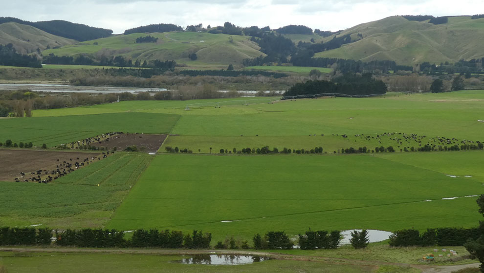
Which transports you back into Canterbury, complete with its dairy induced greenness.

I have a few last spots to check out, starting with a quick visit to the Hurunui river mouth.
Then finally in search of the Kaikoura Coast perfect beach, a little map work turned up a promising candidate. Dead end, long dusty road, (hey no sweat), isolated, desolate, wild windy and dramatic, no houses, no traffic, not another soul for miles (almost). Where? Well those with a bit of their own inner explorer should have no trouble locating it from my (non) description.
And the best thing of all, the new day brings, a new day. New light. New things to explore.
2018-04-16
www.zoneblue.nz/cms/page.php?view=molesworth


Summary
An autumn circuit through Molesworth Station, and returning via the Kaikoura Coast Road.
Mountain Imagery
- South Island 2005
- Taranaki Landscapes
- Taranaki Landscapes 2
- Taranaki Landscapes 3
- Ruahine Landscapes
- Taranaki Landscapes 4
- Taranaki Landscapes 5
- Taranaki Landscapes 6
- Tongariro Landscapes 1
- Tongariro Landscapes 2
- Tongariro Landscapes 3
- Canterbury Landscapes 1
- Motatapu Track
- Pyramid Route
- Kiri Track
- Winter Round The Mountain
- Tongariro Landscapes 4
- Ruapehu RTM
- South Island 2017
- South Island 2017 B
- South Island 2018
- South Island 2018 B
- Molesworth
- Sudden Valley
- South Island 2019
- Mt Fyffe Traverse
- North Island 2020
