Trip7 Four Passes
Date:
22/10/05 -28/10/05
Highlights
- snowy passes, in good weather
- five rivers
- old pack tracks in greenstone country
Route
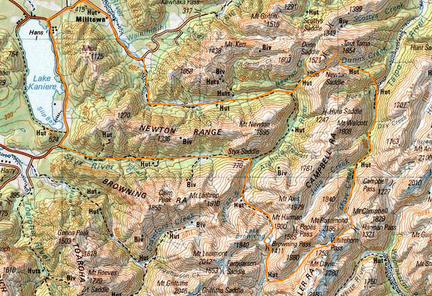
Start at Lake Kaniere
Grassy Flats hut
Harmin Hut
Park Morpeth Hut
Julia Hut
Newton Hut
Lower Arahura Hut
Return
Trip log:
Day 1 17km +700m
Day 2 7km +620m
Day 3 9km +1000m
Day 4 15km +1820m
Day 5 16km +1650m
Day 6 12km +300m
Day 7 18km +200m
walked= 90km +6290m=total climb
After a nice nights camped at Lake Kaniere, I packed and walked to the Start of the Styx valley track. Initially its through farm land and a vehicle track.
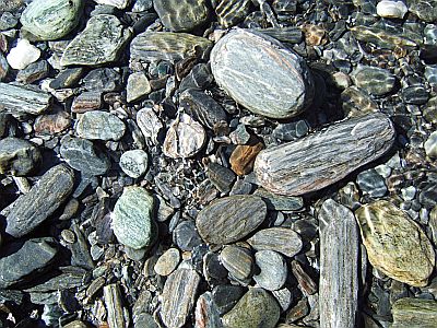
The first thing I noticed was that the rocks here are quite different. This is schist country and these are some river worn stones, of many colours.
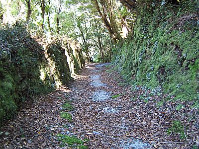
The route guide said something to the effect of `luckily there is a good network of pack tracks built in colonial times`. Brabyn wasn`t wrong, when those miners built a track they really built a track. They are starting to get damaged by rock slides and things in places and of rangers being mostly office workers these days means the tracks we inherited are being maintained. Without these the west coast would just be an impenetrable rain forest.
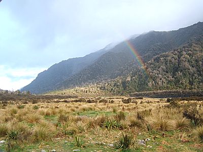
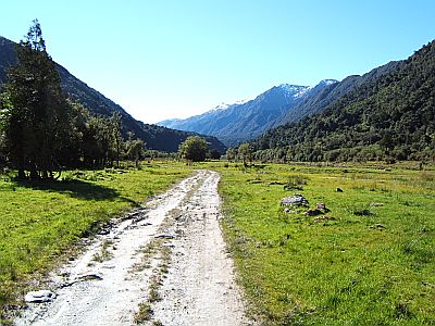
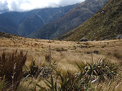
After a few hours you arrive a Grassy flat hut, which interestingly enough is sited in a nice little grassy flat.
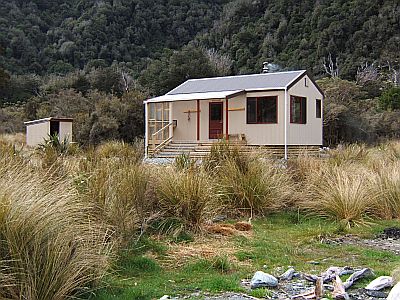
Shock, horror, another new hut. That`s the third in as many weeks. We really are blessed as a tramping nation to have this network of huts.
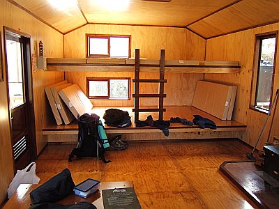
The finishing in this gets 10 points. They avoided the paint used in the other two. Platform bunks are all the rage these days as you can always squeeze a few more in if you need to.
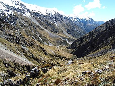
Next day a brief ascent takes you up to the sadle that separates the Styx and the head of the Arahura. It`s a tad boggy.
And then you turn right and head towards the Browning Pass. Nice country and average weather.
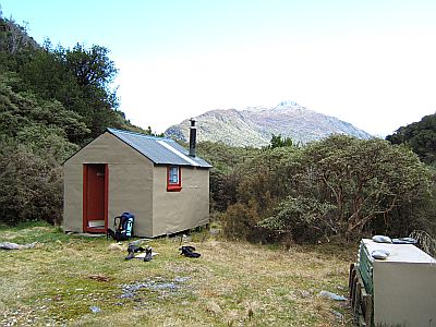
Harmin hut is not only in a nice little spot, and has a view, but it is also strategically placed for the climb over into the Wilberforce River. This one has a stove, and you have to use wood sparingly, because as you can see there aint many trees about.
Higher up theres a bit of rock hopping, as the creek dwindles away, as they do, to nothing.
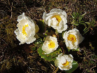
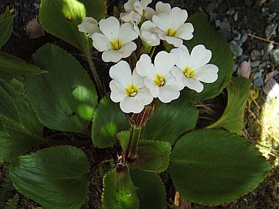
The first Mt Cook Lilies of the season. They go underground over winter and pop up as soon as the snow thaws, and the weather warms up a bit. These have just opened.
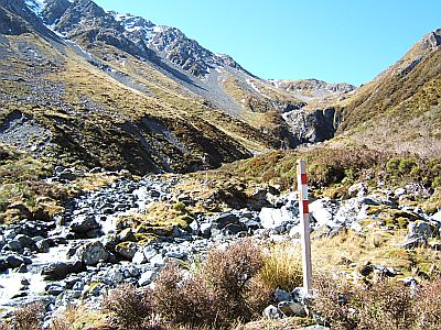
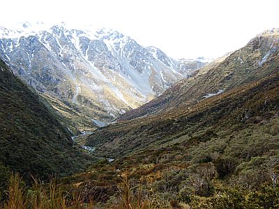
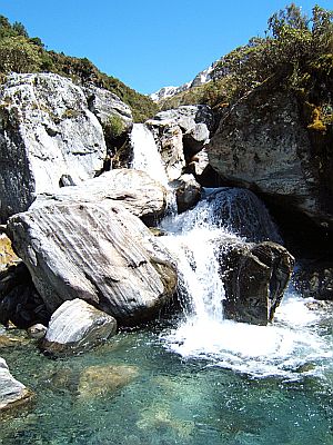
The upper route is poled and theres a bit of windy windy through the bluffs at eh valley head. You sidle up the true right from the `prominent fork` to bypass the waterfall.
Shortly enough you arrive at the Browning Pass, with its pleasant Browning Lake. This is a great place to lunch and explore if you have time. I climbed up the peak to the right a ways, but there were flocks of voracious keas milling about, just waiting for me to put my pack down so they could shred it. I hurried back!
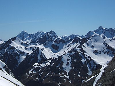
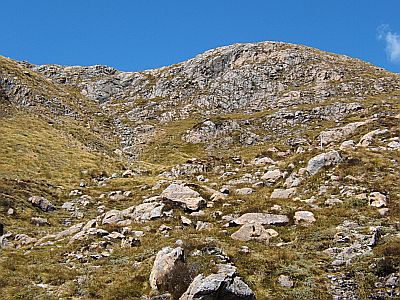
Theres quite a few nice mountains around, and you could easily spend a few days climbing from here. Nice middle sized peaks.
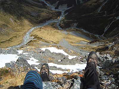
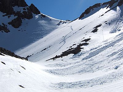
Now they say that Browning Pass is steep on the south side, and they aren`t wrong. Photos looking up or down are always hard to get straight in your brain, but this photo is looking straight down between my legs. That`s the head of the Wilberforce, a large Canterbury high country river. There isn`t much snow just now, as the pass is quite low. Mostly scree.
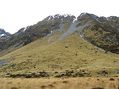
Boy, I fair shot down that scree. (at centre). You can just make out the remains of an old zig zag track, which is still used for those ascending.
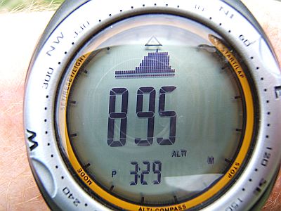
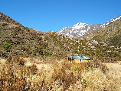
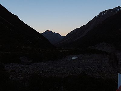
Note the altitude bar graph on my watch. That`s an 8 hour scale--Browning Pass sideways. 895m is the altitude of Park Morpeth Hut at days end. It`s a shortish day but in preparation for a longer one tomorrow.
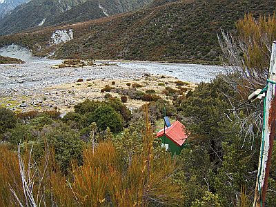
That`s the Park Morpeth Hut. Don`t ask me where the CMC got the name from, when they built it in the 1930s. It too has a mountain radio. The shot is looking down the long aerial run.
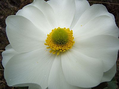
Yes, more Mt Cook Lilies. A weeny bit under exposed.
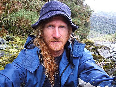
An alpine start for the Whitehorn/ Harmin Pass day.
That`s the True right side of the valley, that you wander up. I forget the name of the creek. If I overcome my laziness ill look it up.
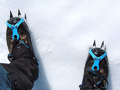
Warming spring conditions means that you only get a few hours first thing of firm snow conditions. Hence the early start. Climbing in crampons on top of the snow is way easier than plugging steps later in the day.
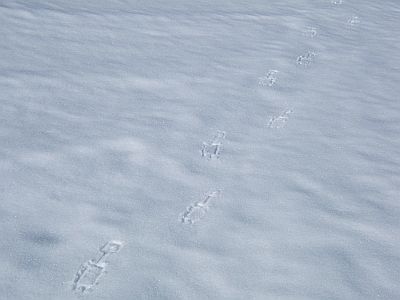
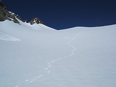
We are already starting to leave tracks as the sun hits the slopes.
This is the final 300, vertical climb up onto the pass. The footprints you can see are a previous party who came over in the slushy afternoon conditions yesterday. I felt right smug, I did, crunching my way up in comfort.
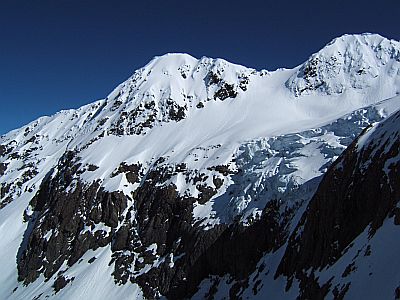
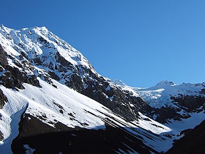
Theres another nice hanging glacier off to the true right. Nice glacier, stay.
We are in serious mountains now.
And over the otherside we go, into the brightest hottest sunshine you can imagine.
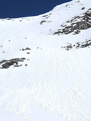
Plenty of wet snow slides in evidence.
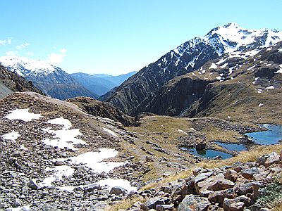
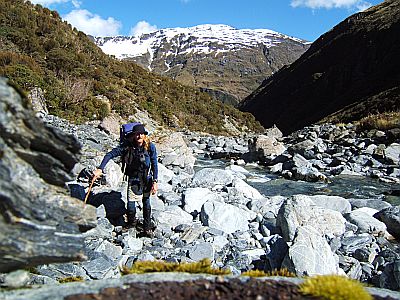
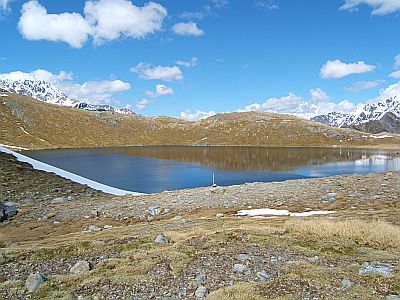
This is the Areal tarns marked on the map. A couple of tourists came up and lunched not more than 50m and hidden from this idyllic lunch spot, because they didn`t know what a tarn was. They asked me and I said, a small lake. Somewhat reminiscent of the when does a creek become a river discussion.
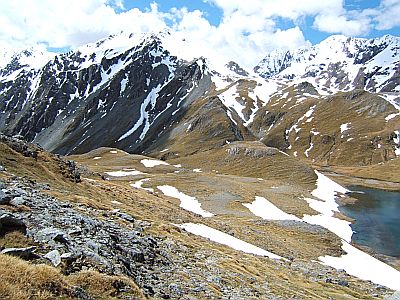
That`s what you have to cross to get to the tarns. A mixture of very soft snow and some very unstable stacks of blocks and rocks.
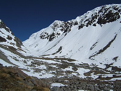
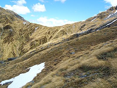
This is a view looking down the Harmin pass to the Taipoiti. As you can see, nil snow, nil avalanche danger. Harmin Pass is actually lower than the tarns.
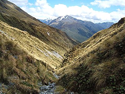
That`s the minor bluffy country you head down into the head of the Taipo. Bear in mind that this trip is a modified three passes route and returns to the west coast from hence it came. The Taipo is the means of our return.
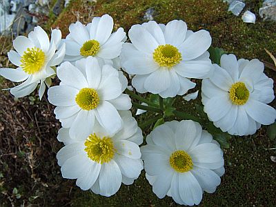
OK, I know I`m overdoing the lilies thing, but honest they are everywhere at the moment, and this is not something that happens everyday.
This is technically called Marys Creek, but I prefer to think of it as the start of the Taipo. And anyway, how does a watercourse of this hoof qualify as a mere creek anyhow?
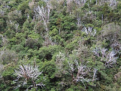
Were on the coast now, and these are Ratas. Dead Ratas. Possum damage they say, but I think you can safely add global warming to the list.
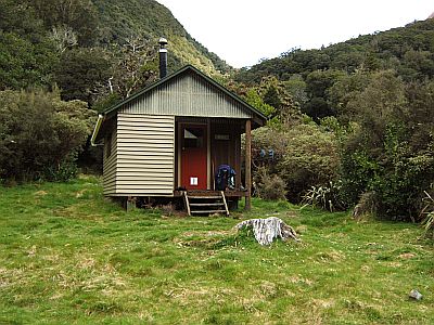
This is an unusual 8 bunk design, rather cute I thought, and id guess about 20 years old. Photos of the exceedingly good hot springs are conspicuously absent, due to the modesty of the soaking participants, not excluding one very cute Indian lass.
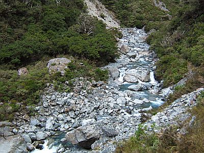
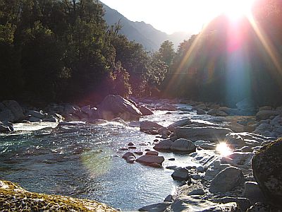
Downstream, or should I say down river, the Taipo gets going.
If you ever happen to see this sign be very very worried. Firstly as I mightve mentioned they don`t do signs around here. Secondly, this particular sign leads to a lesson of almost spiritual significance. What it amounts to is a one meter wide dry (but wet) exceedingly steep creek bed. The catch is the rocks are so slippery that unless you place your feet just so they don`t stay put and down down you go. Every single step had to placed mindfully and patiently, and well, meditatively. But at the top of that excuse for track maintenance, it doesn`t, end and the storys in the Dunns Creek hut are testimony to the fact that many parties underestimate this 4th pass which reconnects those 3 passes aspirants attempting to return to the start of their trip. Newton saddle as its known is a fairly serious undertaking, and can take a whole day. My pack was light and I tend on the nimbler side, and skipped over in under 3.5 hours, but that seems to be the exception.
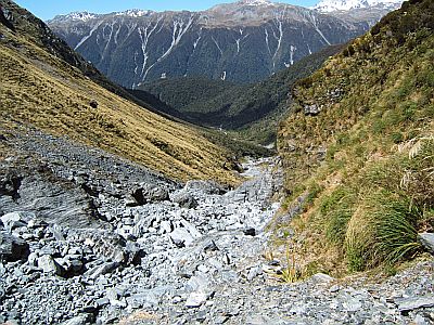
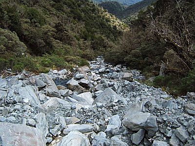
That`s what the guide refers to as `demanding rockhopping`. It beast the impenetrable scrub at the river margins however.
And this side creek just keeps getting steeper and steeper. Until its about 50 degrees. And if that isn`t enough then you have to go into 4 limb drive and literally climb a 100m long 60-70 degree tussock gut, hanging on by nothing more than two good handfuls of tussock. The product of all this climbing is to reach a high traverse so then reach the Newton saddle. (which in turn ostensibly avoids a scrub bash in the other creek below.
That`s the easy high traverse and the relatively low 1200m saddle itself. All the work is below.
Then I pop down the otherside, and its straight into the start of Newton Creek. First its dry then, its well, wet, then it gets wetter, and wetter and slippier and sliperyer. I don`t know what it is about the rocks around here that makes them so slippery, its some kind of algae I think.
Note that the camera angle here is about 45 degrees. I would never in a million years walk up Newton creek. At least going down the form of rock hopping you employ can be could be called controlled rock sliding. It goes against the laws of the universe to be able to rock slide up hill. Bear in mind that we are talking about something of a cascade of rocks several meters in size. Basically its that old tactic of using the creek to blaze and maintain a conduit though the jungle. Im not joking about jungle, this is the coast, its thick as and you can take a look at my closed cell matt if you want an insight into what bush crashing in this stuff is like. Ok, ive made my point, consider yourself duly warned.
Not lilies but something else. Ask a botanist. Although you have to admit white and yellow is something of a theme.
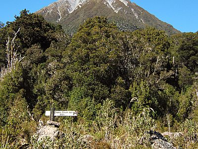
The reward for your days efforts is the `delightfully situated` Newton Creek Hut. Im not really sure whats delightful except that given the atrocious access from any direction you are just jolly happy to be there. This hut has been on DoCs `connunity maintenance` list, and has for the last few years been adopted by a local character, who has made it quite tidy and cosy. Despite all the access issues a suprising number of people visit, in part because its been adopted and is known as a really enjoyable little hut to stay in. However now it appears that the success of it has led to DoC reapproriating it. Isn`t that just typical, and insulting to the caretakers efforts if you ask me.
The pseudo track out of the valley is made tricker by new rain. Im looking a bit bedraggled there. Once you cross the swingbridge over the Arahura you again are confronted by one of these steep dry creek bed excuses for tracks. Only now its raining and it aint no dry creek bed! I don`t have any photos for the simple reason that these are dark damp soggy slippy, places--no place for photography.
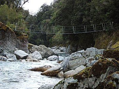
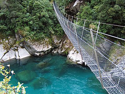
One of dozens of swing bridges in these coastal valleys that make the difference of going or staying at home.
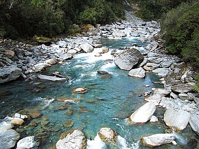
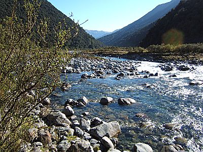
That`s the Arahura river, and even without the whole greenstone thing, the river is stunningly beautiful.
This is taken on my eveing greenstone journey, hopping along the river bank as far as the Olderog Creek junction. `The stuff is lying all over the place` as it says in the hut book, and indeed it is. It helps to know where to look, and it transpires that the greenstone exists in a narrow band right on the alpine fault. Aka Olderog and Jade creek.
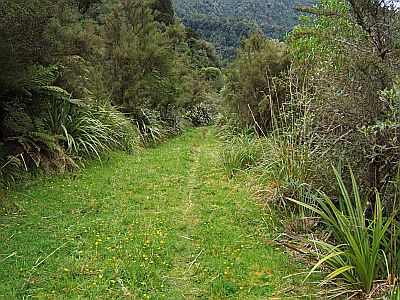
The track out from the Lower Arahura hut is a bulldozer affair of a thing that some well meaning stone gather put it. Works for me.
And the final exit to the valley is via this bridge over a swirling water feature known locally as the cesspool. Prettiest cesspool I ever saw.
2008-10-25
www.zoneblue.nz/cms/page.php?view=trip7-four-passes


