Trip11 Rees Dart
Date:
26/11/05 - 30/11/05
Highlights
- Stunningly beautiful country
- lots of great sidetrips
- excellent track condition; tourist numbers increasing
Route
Start at Rees Road end
Shelter rock hut
Side trip to 2185
Dart Hut
Side trips to cascade saddle and hill opposite hut
Daley Hut
Dart carpark
Trip log:
Day 1 16km +400m
Day 2 16km +1400m
Day 3 20km +1000m
Day 4 19km +150m
Day 5 23km +150m
walked= 94km +3100m=total climb
After a few days off on the Oamaru coast and in Dunedin, I was left with about 3 weeks to spend in Mt Aspiring National Park. I started in the southwest, where the scenery around Glenorchy and Queenstown is something else.
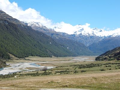
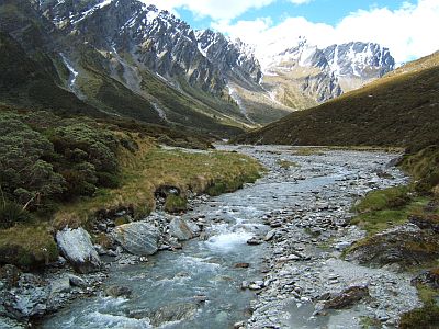
From the Ress carpark, you walk first in an open farmed valley. The Rees River is relatively minor and the riverbed travel is made easy by crossing a couple of times. Mt Earnslaw is the highish mountain in the clouds. The valley makes for a pleasant days walk, with more than one long stop for lunch and a seista.
The middle section is forested...
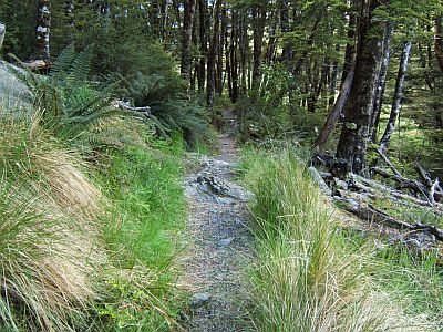
...although more than occasionally punctuated with grassy clearings.
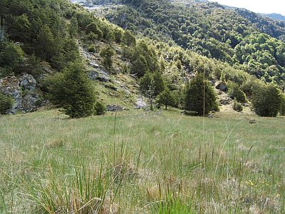
Kind of reminds me of Swiss alpine meadows.
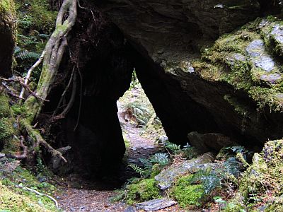
And just for the fun of it the track passes under a large rock or two.
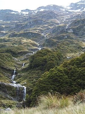
The snow melt is in full swing now and there are waterfalls and riverlets pouring off all the hills.
Just on the bushline at 900 or so meters asl. you arrive at the 20 bunk Shelter rock hut. All huts here are well used (being a named track) have stoves, wardens and HF radios.
This is the view up river from the hut.
And this is the view of the headwaters of the Rees you get after climbing to the Rees saddle the next day.
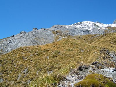
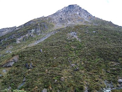
From Rees saddle, based of a positive mention from the Moirs guide, I decided to climb the peak labelled 2185. Steep tussock at first...
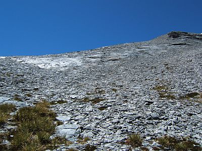
Then a short sharp `scrabble` up a section of schisty scree before hitting the firm snow at about 1800m
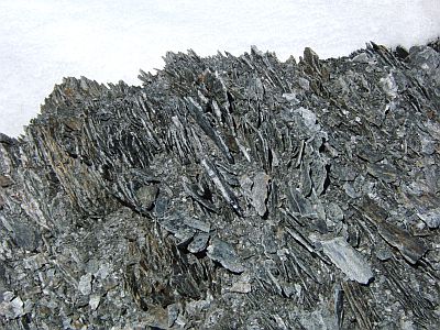
The rock here is entirely this pale grey schist. Its quite soft underfoot.
That`s the arete near the summit of 2185.
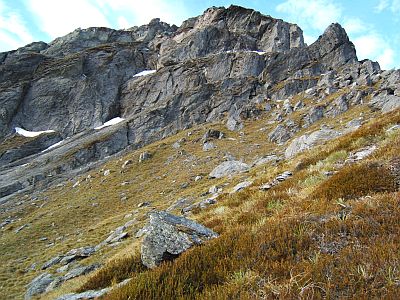
The views are really magnificant, including east to the Shotover river and Lake Lochnigar. As you can see its quite barren country, largely treeless, and solidly grazed most of it.
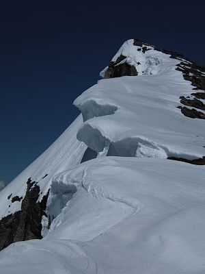
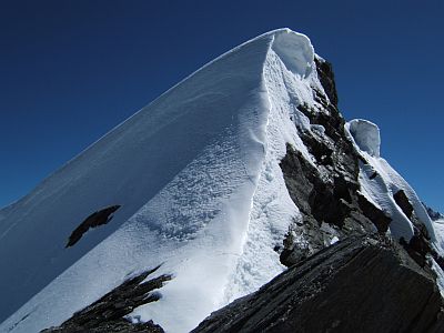
Real groovy cornices. Pretty stable at present, 6am start and all.
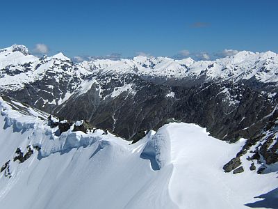
The view west is these three ranges. The foreground corniced ridge runs between 2185 and its neighbours. The rocky ridgeline separates the Rees and the Dart; and the distant range is to the west of the Dart.
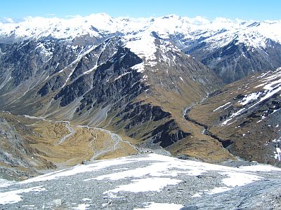
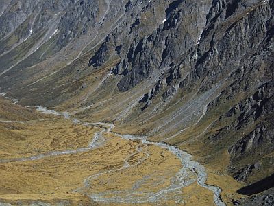
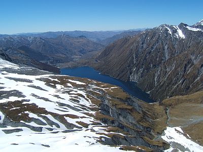
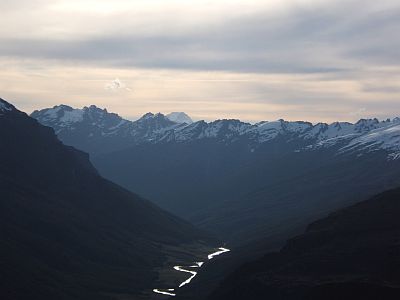
Looking back the way you came, this view shows clearly the Rees valley at left, the Rees saddle middle, and Snowy river at right which leads into the Dart.
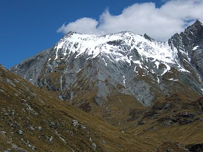
Looking north that`s Mt Headlong and the head of the snowy. Note the platinum grey sheen to the rock--that`s the schist which is quite sparkley.
After much soaking up of the panoramic views (when Moirs says magnificent views it means magnificent views) a quick descent. Looking back you can see 2185 at left, and the ridge with its twin, then Mt Impact, which is a more difficult proposition.
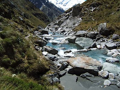
After descending the length of the snowy river, you cross the swingbridge, and continue to the Dart confluence. Its really hot by now, and I think we can safely say goodbye to spring. The waters still cold but bearable when youre hot enough!
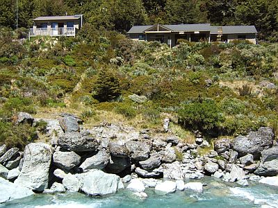
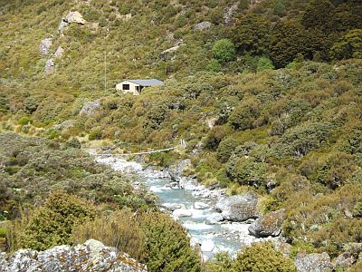
That`s the new Dart hut, which sleeps 30 or so. It also has a wardens quarters with enough room to swing a cat.. The Dart hut is a great place to base for daytrips. Being nearly December the tourist numbers are very much starting to pick up and the Dart Hut had about 15 people in it.
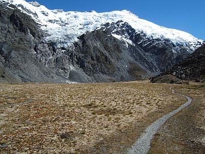
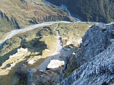
Most visitors spent a day walking up to cascade saddle and back. I was lazy and went about half way. As you see it`s a pretty well worn route.
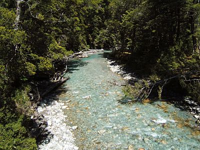
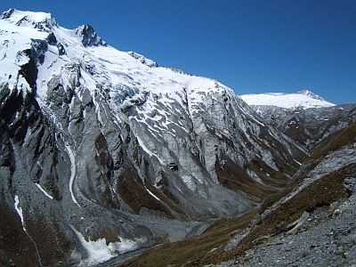
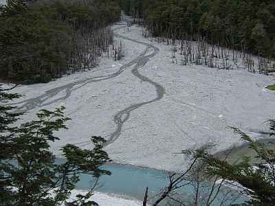
The trip to Cascade saddle is made interesting by the fact that the route follows the Dart Glacier. This is the very greeny grey river that is the extremely cold beginning of the Dart.
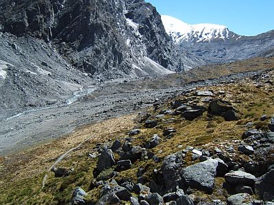
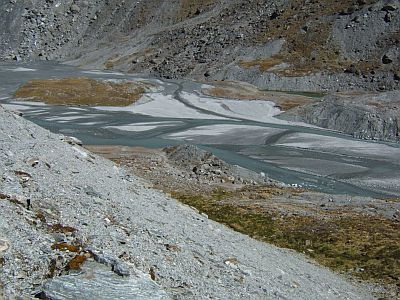
The quarry-like Dart terminal is seen here just below Cascade Saddle, upper right. My return route abandoned the track and followed the riverbed.
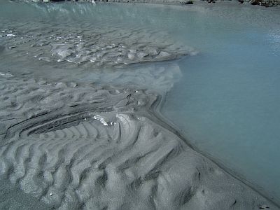
Doing so one has to watch out for quicksand, as seen here. It occurs where pockets of ice melt below silt accumulations. One leg disappearing up to the knee, educated me pretty promptly.
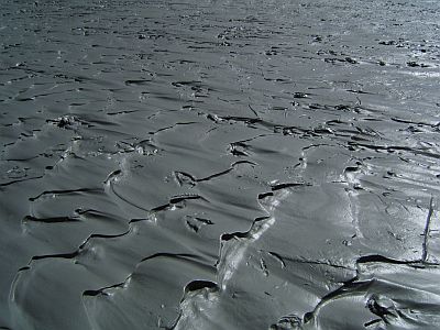
The glacial silt, being comprised of the same schist, makes for nice fine sparkly silt.
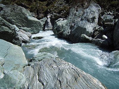
Finally the river constricts to a small gorge and a final boulder hop takes you back to the hut.
After the siesta, I rock hopped up the snowy as far as the waterfalls. That`s definitely recommended especially when its so hot, and takes about 1 hour return.
Then about 5pm (the days are really really long now), I decided to climb up the peak immediately opposite the hut. Its actually the end of a spur running off the Marion Towers, and about 1800m, buts its very steep and a bit of a climbing route.
That`s looking straight down at the hut, and the dry creek I used to ascend. You have to cross the Upper Dart, which should be treated, even at its upper, with caution. (lower down forget it this time of year).
It`s a challenging climb with a lot of time spent route finding. Basically you traverse left, then follow steep right leaning fracture lines. I got as far as the pinnacle at right near the top. The last 100m vertical is in a steep narrow hidden snow chute.
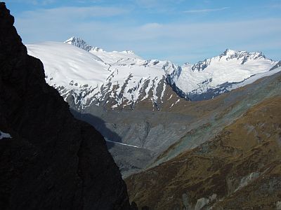
Pretty good views, including this one looking over the Cascade Saddle to the Matukituki and Mt Aspiring at left.
Looking back down the Dart valley at about 7pm. Not sure what the higher peak in the far distance is.
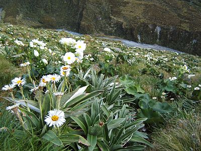
The descent involves picking your way back down through the bluffs, and descending the massive fields of wildflowers. A mixture of lilies and daisies. Dart below.
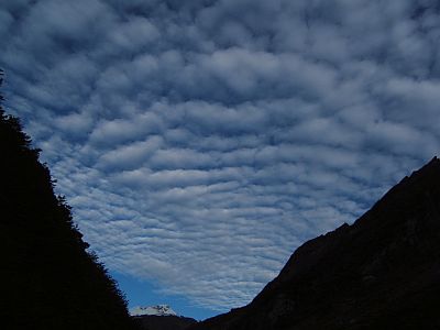
Flopping back to the hut after a fairly active day. At 8pm the hut is dead quiet, with everyone else having already dined, and having hit the hay after a long sun burnt day up at the saddle. Looks like the weather is changing. We have been blessed with 6 absolutely beaut days on this trip.
Next day, another supposedly 6 hour leg down the Dart to Daley Hut. The route passes through a very large cattle flat (without cattle). Basically the cold oozing down from the glacier depresses the bush line quite some altitude below normal.
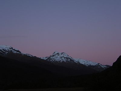
Still the evening proves clear still.
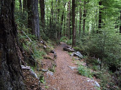
Daley is serious sandfly territory so I don`t hang around. The track down valley is a brand new benched marvel, but sticks to the forest all the way.
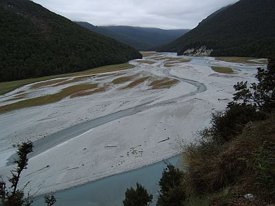
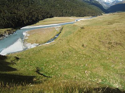
As for the river, its growing into the big braided thing that it is. The last 2 hours you can hear the V8 jetboats, which use the river as a sort of highway.
Various side creeks tend to dump large quantities of gravel and rocks, whenever there is a big storm.
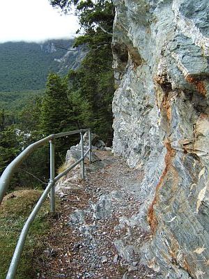
Finally there are a couple of very serious bluffs which would otherwise necessitate large climbs to detour around, but the track has been pushed through with liberal use of explosives. Not exactly conservation from a green green point of view but damn fine by me.
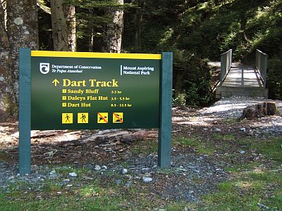
This is sign country. Now all you have to do is figure out how to get back to the car. I walked about 8kms, before fluking a ride the rest of the way, with a lost climber.
All round, the Rees Dart turned out to be a lot more interesting than I thought it would be, and the weather allowed some really great climbing. A memorable trip indeed.
2008-10-25
www.zoneblue.nz/cms/page.php?view=trip11-rees-dart


